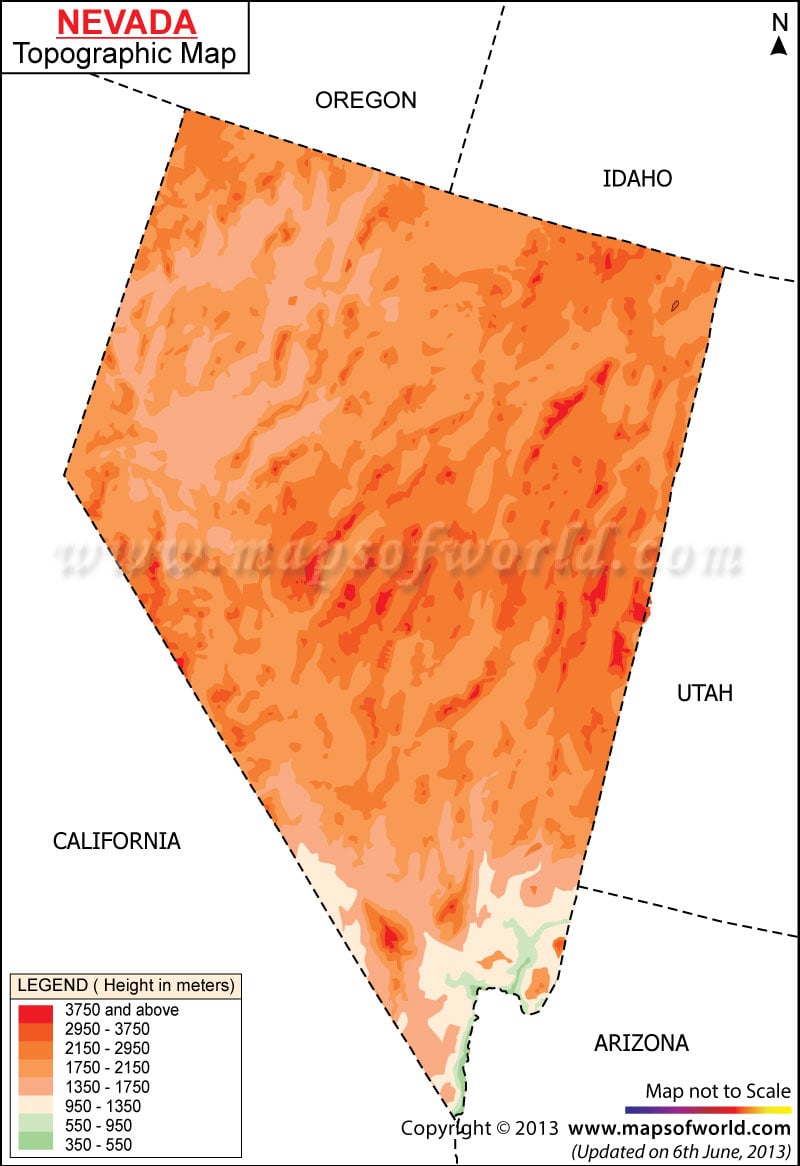
The northern and southern parts of Nevada are covered by the high and low mountains of the place. Toiyabe, Ruby, Carson and Schell Creek are the most important mountain ranges of the State. Situated at an altitude of 4,007 meter (13,140 feet) in the southwestern part of the state, the Boundary Peak is the highest point of Nevada. The lowest point of the State of Nevada is River Canyon which is at 479 feet (146 meter) above the sea level. Many rivers, streams and lakes flow through the State of Nevada. Truckee River, Humboldt River and Colorado River are the most important rivers of Nevada. The biggest river of Nevada is River Humboldt which flows through the northern part of the state into the Humboldt Sink. Lake Tahoe, Pyramid Lake, Lake Mojave and Lake Mead are some of the notable lakes of Nevada. The Nevada State Map indicates the diverse topography of the state.
Nevada Topographic Map
The Nevada Topographic Map clearly mentions the various relief features of the state. The heterogeneous topography of the State of Nevada is characterized by the Great Basin, plateau, exotic mountain ranges and dry basins. The State of Nevada comes under the drainage system of the Great Basin.
