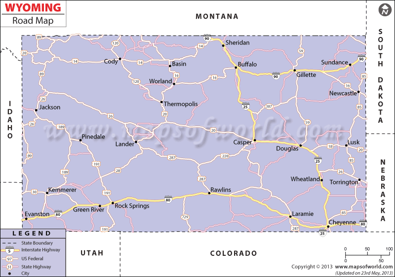
Interstate 80, Interstate 25 and Interstate 90 are the three major state highways of Wyoming that connect most of the towns of the state. The towns namely Riverton, Shoshoni, Thermopolis, Afton, Alpine, Saratoga, Evanston, Lander, Dubois, Wheatland, Buffalo and many others are highlighted in the Wyoming Road Map.
All these towns are well-linked with the extensive network of roadways of Wyoming. According to a survey in the year of 2000, the state of Wyoming was equipped with a total of 43, 722 km of roads. Buses are the prime mode of road transportation in Wyoming state. The road map of Wyoming, apart from pointing out the important towns of the state, also highlights other cities.
Towns of Gillette, Glenrock, Glendo, Big Piney, Rawlins, Kemmerer, Jackson, Sundance, New Castle and Casper, among others are also depicted in the Wyoming road map. The states which border Wyoming like Nebraska, Montana, Utah, Colorado and South Dakota are clearly marked in the road map of the state. Tourists traveling to the state can get significant guidance relating to the road routes from the Wyoming road map. It can be said that the road map of Wyoming state provides a clear outline of the entire road network of the place.
 Wall Maps