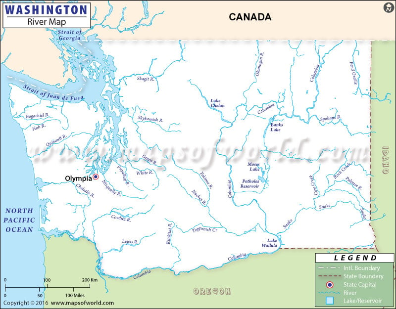
The rivers, lakes and streams flowing through the state are clearly marked in the Washington River Map.
Snake River, Columbia River and Yakima River are some of the prominent rivers of the state. The Columbia River drains 1,900 kilometer of the total length of the state. River Columbia flows through the middle of Washington and drains into the Pacific Ocean.
In terms of length, Columbia River is the longest river of the State of Washington and discharge 7,400 cu m of water in an average. River Snake flows through the Idaho region in the southwestern part of Washington and drains into Columbia River beside Pasco.
Lake Washington and Lake Franklin D. Roosevelt are some of the renowned lakes of the state.
Franklin D. Roosevelt Lake encompasses total area of 319 square kilometer. The Washington State Map points out the several dams of the state. The Grand Coulee Dam, constructed on the upper part of River Columbia is one of the biggest dams of the United States of America. Lewis River, Naches River, Touchet River, Sanpoll River, Spokane River, Cowlitz River and Wenatchee River are some of the other notable rivers of Washington. Moses Lake, Banks Lake and Chelan Lake are few of the other important lakes of Washington.
 Wall Maps