The state of Vermont is situated in the New England Region of the U.S. The state covers a total area of 9,620 sq miles and by area, it ranks as the 45th biggest state in the country.
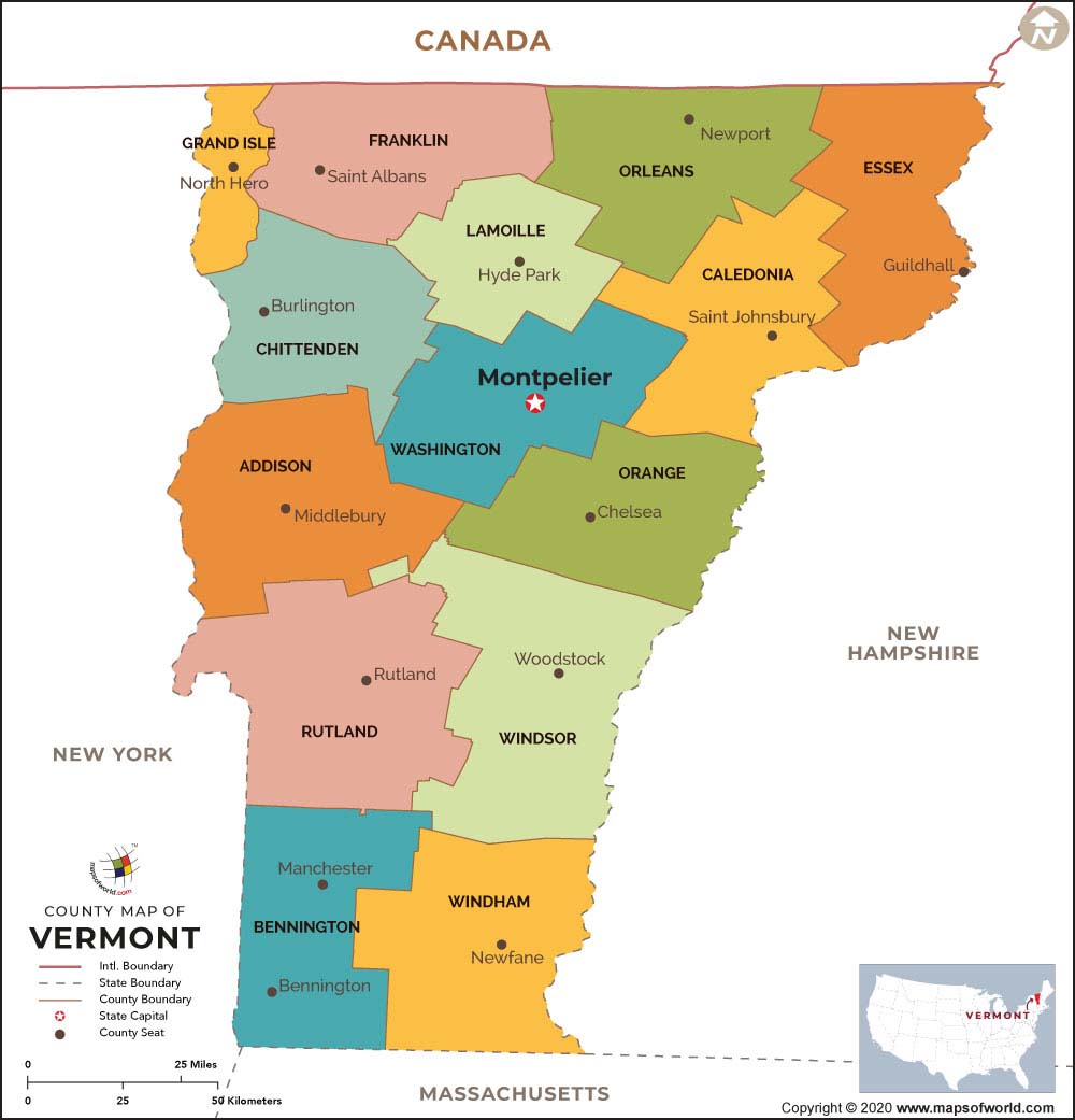
Vermont is a small state in the northeastern part of the U.S. It edges Massachusetts, New Hampshire, Quebec in Canada, and New York. A Vermont County Map demonstrates all the 14 counties in Vermont.
About Vermont County Map
At present, the state of VT consists of 14 counties. The counties in Vermont house 255 political divisions, incorporating nine cities, 237 towns, four gores, and five unincorporated places. Every county in the state of VT is governed by its respective county seats, called shire towns. Montpelier, the state’s capital, is the shire town of Washington County. Washington County was previously named Jefferson County. Below are the counties’ names in Vermont and their significant details.
Maps of All Vermont Counties
- Addison County Map, Vermont
- Bennington County Map, Vermont
- Caledonia County Map, Vermont
- Chittenden County Map, Vermont
- Essex County Map, Vermont
- Franklin County Map, Vermont
- Grand-Isle County Map, Vermont
- Lamoille County Map, Vermont
- Orange County Map, Vermont
- Orleans County Map, Vermont
- Rutland County Map, Vermont
- Washington County Map, Vermont
- Windham County Map, Vermont
- Windsor County Map, Vermont
 Wall Maps