1.3K
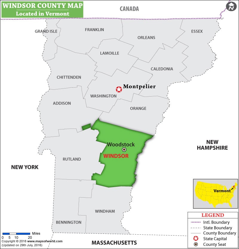
Facts about Windsor County
| County | Windsor |
| State | Vermont |
| Country | USA |
| Population – 2015 | 55,737 |
Check this Vermont County Map to locate all the state’s counties on Vermont Map.
List of Counties in Vermont |
|||||
|---|---|---|---|---|---|
| County Name | County Seat/Capital | State | 2010 pop. | Area-km | Area-mi |
| Addison | Middlebury | Vermont | 36,821 | 1,985 | 766 |
| Bennington | Manchester | Vermont | 37,125 | 1,748 | 675 |
| Caledonia | Saint Johnsbury | Vermont | 31,227 | 1,681 | 649 |
| Chittenden | Burlington | Vermont | 1,56,545 | 1,390 | 537 |
| Essex | Guildhall | Vermont | 6,306 | 1,719 | 664 |
| Franklin | Saint Albans | Vermont | 47,746 | 1,641 | 634 |
| Grand Isle | North Hero | Vermont | 6,970 | 212 | 82 |
| Lamoille | Hyde Park | Vermont | 24,475 | 1,188 | 459 |
| Orange | Chelsea | Vermont | 28,936 | 1,779 | 687 |
| Orleans | Newport | Vermont | 27,231 | 1,796 | 693 |
| Rutland | Rutland | Vermont | 61,642 | 2,408 | 930 |
| Washington | Montpelier | Vermont | 59,534 | 1,780 | 687 |
| Windham | Newfane | Vermont | 44,513 | 2,034 | 785 |
| Windsor | Woodstock | Vermont | 56,670 | 2,511 | 969 |
 Wall Maps