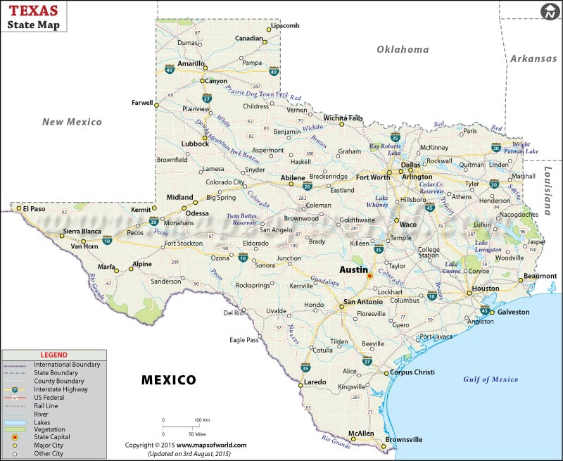
Steeped in cowboy lore, Texas is a real image of the American South. From northern panhandles in Amarillo to southern coastal plains in Houston and the Trans-Pecos region in the west, the state has 10 climatic regions. The state capital Austin is also referred as the “Live Music Capital of the World.”
Texas is second most populated state in the US after California. There are 254 counties in Texas, more than any other US state. Fort Worth, Dallas, El Paso, and San Antonio are other major cities in the state.
Tourist Attractions in Texas
From music festivals in Austin to museums in Houston and rodeo shows in small towns, Texas offers round-the-clock entertainment.
- San Antonio Missions National Historical Park
- Moody Gardens
- Guadalupe Mountains National Park
- Big Bend National Park
- Sixth Floor Museum at Dealey Plaza
- Space Center Houston
- Texas State Capitol
- Padre Island
- Caddo Lake
Getting In and Around
Dallas/Fort Worth International Airport (DFW) and George Bush Intercontinental Airport (IAH) in Houston are major airports in Texas.
Amtrak operates Sunset Limited, Texas Eagle, and Heartland Flyer through the state.
I-10, I-20, I-35, and I-45 are some of the primary interstate highways.
 Wall Maps