- Texas Counties - Texas County Map, Map of Texas Counties
- Major Cities of Texas - San Antonio, Galveston, Houston, Dallas, Fort Worth, Abilene, Austin, Arlington, El Paso, Grand Prairie, Irving City, Mesquite City
- Neighbouring States - Louisiana, Arkansas, Oklahoma, New Mexico
- Regional Maps - Map of USA
- Other Texas Maps - Texas Map, Texas Physical Map, Texas Airports Map, Texas Lat Long Map, Texas Zip Code Map, Texas Area Code Map, Texas National Parks Map
Accurate Geographical Location of Texas
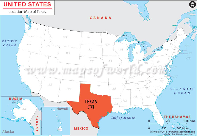
The Texas Location Map indicates the accurate geographical position of the state. Situated in the western part of the south-central United States of America within the coordinates 31.0° N, 100.0° W, Texas is the second largest state of the country.
Texas is surrounded by New Mexico from its western side, Oklahoma from northern side, by Arkansas and Louisiana on its eastern side, by the Gulf of Mexico on its southeastern side and by the country Mexico from its southwestern side.
Facts About Texas
| State Name | Texas |
|---|---|
| Country | US State |
| Capital | Austin |
| Largest city | Houston |
| Area | 268,581 sq mi (696,241 km2) |
| Population | 27,695,284 (2015 est) |
| Lat Long | 31° 0′ 0″ N, 100° 0′ 0″ W (31, -100) |
| Official Language | No official language |
| Calling Code | |
| Time Zone | Central: UTC −6/−5 Mountain: UTC −7/−6 |
| Airport | 730 airports |
| Neighbour countries | New Mexico, Oklahoma, Arkansas, and Louisiana. |
| Internet TLD | |
| Currency | Dollar |
 Wall Maps