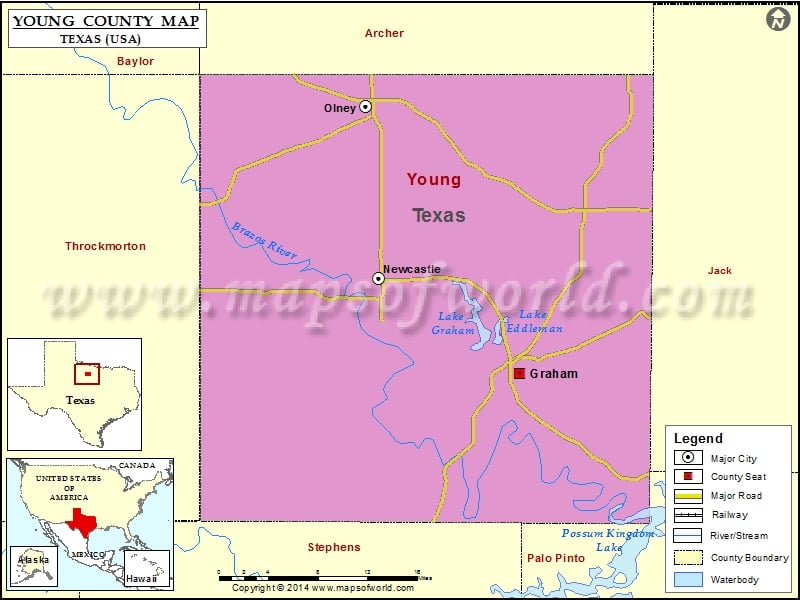
Check this Texas County Map to locate all the state’s counties in Texas Map.
Mountain Peaks in Young County
| Mountain Peak/Hill | Elevation [Meter] |
|---|---|
| Bare Mountain | 362 |
| Bass Mountain | 346 |
| Beehive Mountain | 419 |
| Cement Mountain | 410 |
| Crow Peak | 379 |
| Dobbs Hill | 347 |
| Flag Mountain | 417 |
| Haynes Mountain | 356 |
| Indian Mountain | 434 |
| Kisinger Mountain | 379 |
| Rattlesnake Mountain | 319 |
| Round Mountain | 349 |
| Shin Oak Mountain | 380 |
| Sidney Mountain | 353 |
| Skid Mountain | 371 |
| Spy Knob | 348 |
| Tackett Mountain | 406 |
| Wolf Mountain | 420 |
Airports in Young County
| Airport Name |
|---|
| Graham Municipal Airport |
| Olney Municipal Airport |
| Rob Airport |
| Rosser Ranch Airport |
Cities in Young County
| City | Population | Latitude | Longitude |
|---|---|---|---|
| Graham city | 8903 | 33.101652 | -98.577852 |
| Newcastle city | 585 | 33.195034 | -98.743561 |
| Olney city | 3285 | 33.364387 | -98.75837 |
Golf Courses in Young County
| Name of Golf Course | Latitude | Longitude |
|---|---|---|
| Graham Country Club-Graham | 33.10768 | -98.589521 |
| Olney Recreation Assoc. & Country Club-Olney | 33.37059 | -98.752094 |
 Wall Maps