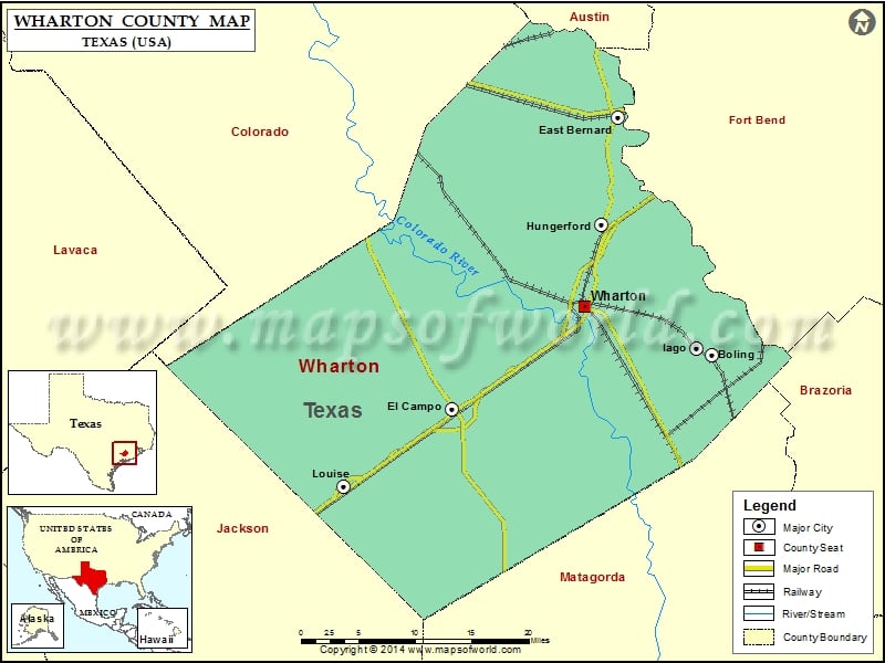
Check this Texas County Map to locate all the state’s counties in Texas Map.
Mountain Peaks in Wharton County
| Mountain Peak/Hill | Elevation [Meter] |
|---|---|
| Peach Break | 27 |
Airports in Wharton County
| Airport Name |
|---|
| Flying V Ranch Airport |
| Frels Airport |
| Gulf Coast Medical Center Heliport |
| Lackey Aviation Airport |
| New Gulf Airport |
| Norris Raun Ranch Airport |
| Rodgers Roost Airport |
| Shanks Agricultural Strip |
| Smith Aviation Inc Airport |
| Station 30 Heliport |
| Stovall Ranch Nr 1 Airport |
| T-Ranch Airport |
| Tgp 17 Heliport |
| Tradewind Agricultural Airport |
| Wharton Regional Airport |
Cities in Wharton County
| City | Population | Latitude | Longitude |
|---|---|---|---|
| Boling | 1122 | 29.258399 | -95.943552 |
| East Bernard city | 2272 | 29.524078 | -96.062184 |
| El Campo city | 11602 | 29.198189 | -96.273803 |
| Hungerford | 347 | 29.403997 | -96.083707 |
| Iago | 161 | 29.266512 | -95.963005 |
| Louise | 995 | 29.111904 | -96.412334 |
| Wharton city | 8832 | 29.313678 | -96.104404 |
Golf Courses in Wharton County
| Name of Golf Course | Latitude | Longitude |
|---|---|---|
| El Campo Country Club-El Campo | 29.23503 | -96.310545 |
| Newgulf Golf Club-Boling | 29.25094 | -95.899729 |
| Wharton Country Club-Wharton | 29.302826 | -96.072419 |
 Wall Maps