1.3K
Check this Texas County Map to locate all the state’s counties in Texas Map.
Airports in Lamar County
| Airport Name |
|---|
| Burress Airport |
| Cox Field |
| Flying Tigers Airport |
| Forest Hill Airport |
| Paris Regional Medical Center Heliport |
| Parson Field |
| Powderly Airport |
| Womack Plantation Airport |
More Maps of Lamar County
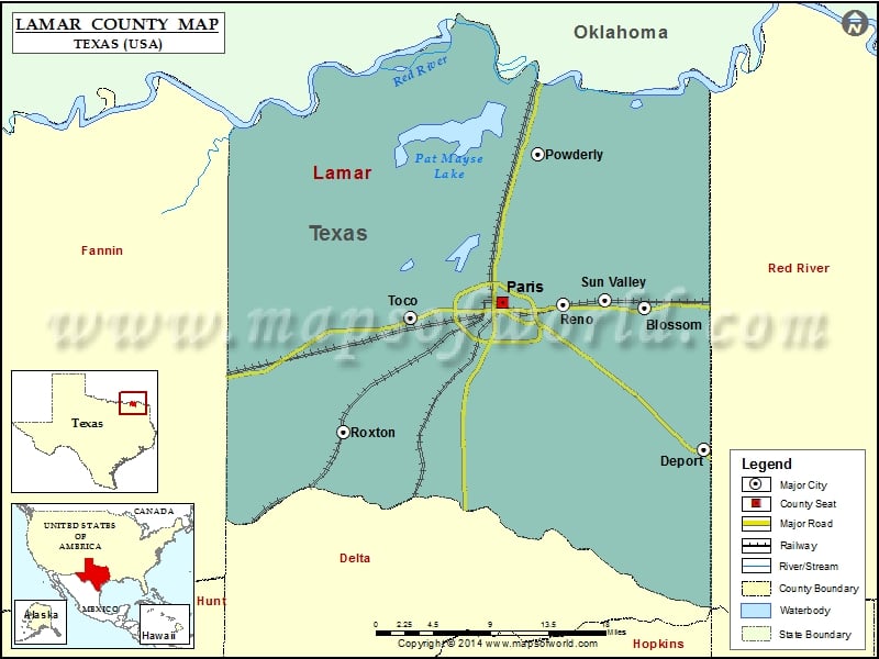
Cities in Lamar County
| City | Population | Latitude | Longitude |
|---|---|---|---|
| Blossom City | 1494 | 33.663232 | -95.383466 |
| Deport city | 578 | 33.529148 | -95.317422 |
| Paris city | 25171 | 33.668499 | -95.54426 |
| Powderly | 1178 | 33.809022 | -95.504912 |
| Reno city | 3166 | 33.666154 | -95.476563 |
| Roxton city | 650 | 33.545336 | -95.724785 |
| Sun Valley city | 69 | 33.671121 | -95.428747 |
| Toco city | 75 | 33.653946 | -95.649188 |
Golf Courses in Lamar County
| Name of Golf Course | Latitude | Longitude |
|---|---|---|
| Elk Hollow Golf Club-Paris | 33.683049 | -95.510189 |
| Paris Golf & Country Club-Paris | 33.708116 | -95.482632 |
| Pine Ridge Golf Course-Paris | 33.670125 | -95.480472 |
 Wall Maps