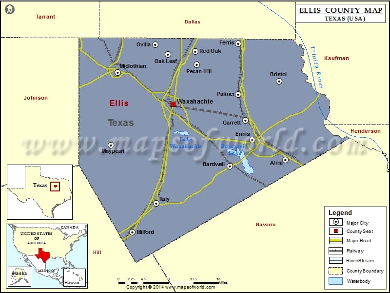
Check this Texas County Map to locate all the state’s counties in Texas Map.
Airports in Ellis County
| Airport Name |
|---|
| Air Ranch Estates Airport |
| Baylor Medical Center Heliport |
| Bee Creek Airport |
| Cedar Circle Heliport |
| Coyote Crossing Airport |
| Dale Acres Airport |
| Dallas South Port Airport |
| Draggintail Acres Airport |
| Eagle’s Nest Estates Airport |
| Eisenbeck Ranch Airport |
| Ennis Municipal Airport |
| Ferris Red Oak Municipal Heliport |
| Flying B Ranch Airport |
| Flying O Airport |
| George P Shanks Airport |
| Harper Airport |
| Haven Field |
| Hirok Airport |
| Hurn Airport |
| Lake Pointe Medical Center Heliport |
| Mid Way Regional Airport |
| Mims Farm Ultralightport |
| MX Ranch Heliport |
| O’Brien Airpark |
| Skylark Airport |
| Tsa Gliderport |
Cities in Ellis County
| City | Population | Latitude | Longitude |
|---|---|---|---|
| Alma town | 331 | 32.28177 | -96.551625 |
| Bardwell city | 649 | 32.267076 | -96.695539 |
| Bristol | 668 | 32.455037 | -96.567212 |
| Ennis city | 18513 | 32.326076 | -96.638045 |
| Ferris city | 2436 | 32.536934 | -96.673768 |
| Garrett town | 806 | 32.368061 | -96.654326 |
| Italy town | 1863 | 32.185741 | -96.886617 |
| Maypearl city | 934 | 32.313892 | -97.005481 |
| Midlothian city | 18037 | 32.474112 | -96.987293 |
| Milford town | 728 | 32.121389 | -96.949788 |
| Oak Leaf city | 1298 | 32.51379 | -96.85636 |
| Ovilla city | 3492 | 32.535301 | -96.889592 |
| Palmer town | 2000 | 32.4248 | -96.67338 |
| Pecan Hill city | 626 | 32.490714 | -96.781333 |
| Red Oak city | 10769 | 32.520245 | -96.786092 |
| Waxahachie city | 29621 | 32.403576 | -96.842818 |
Golf Courses in Ellis County
| Name of Golf Course | Latitude | Longitude |
|---|---|---|
| Eagle Rock Golf Club-Ennis | 32.404228 | -96.65308 |
| Ennis Country Club-Ennis | 32.336704 | -96.661569 |
| Old Brickyard Golf Course-Ferris | 32.540081 | -96.659454 |
| Pecan Trails Golf Course-Midlothian | 32.524384 | -96.949235 |
| Red Oak Valley Golf Course-Red Oak | 32.499332 | -96.82173 |
| Waxahachie Country Club-Waxahachie | 32.403609 | -96.867586 |
 Wall Maps