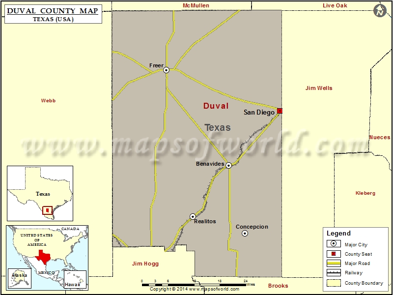
Check this Texas County Map to locate all the state’s counties in Texas Map.
Mountain Peaks in Duval County
| Mountain Peak/Hill | Elevation [Meter] |
|---|---|
| Cedro Hill | 201 |
| Piedritos Hill | 207 |
| San Cajo | 214 |
| Sarnosa Hill | 213 |
More Maps of Duval County
Airports in Duval County
| Airport Name |
|---|
| 4-G Ranch Airport |
| Barronena East Airport |
| Barronena Ranch Airport |
| Douglass Ranch Airport |
| Duval County Ranch Co Airport |
| Duval Freer Airport |
| Hamilton Ranch Airport |
| O S Wyatt Airport |
| Temple Ranch Airport |
Cities in Duval County
| City | Population | Latitude | Longitude |
|---|---|---|---|
| Benavides city | 1362 | 27.598163 | -98.409535 |
| Concepcion | 62 | 27.395133 | -98.355628 |
| Freer city | 2818 | 27.882338 | -98.618056 |
| Realitos | 184 | 27.445416 | -98.530156 |
| San Diego city | 4488 | 27.760891 | -98.238906 |
 Wall Maps