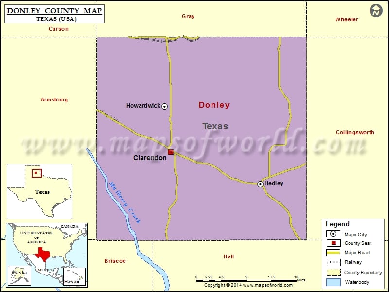
Check this Texas County Map to locate all the state’s counties in Texas Map.
Mountain Peaks in Donley County
| Mountain Peak/Hill | Elevation [Meter] |
|---|---|
| Gunboat Mountain | 895 |
| Mount Ararat | 949 |
Airports in Donley County
| Airport Name |
|---|
| Hedley Airport |
| Smiley Johnson Municipal-Bass Field |
Cities in Donley County
| City | Population | Latitude | Longitude |
|---|---|---|---|
| Clarendon city | 2026 | 34.936645 | -100.891792 |
| Hedley city | 329 | 34.867384 | -100.65905 |
| Howardwick city | 402 | 35.035087 | -100.908318 |
Golf Courses in Donley County
| Name of Golf Course | Latitude | Longitude |
|---|---|---|
| Clarendon Country Club-Howardwick | 35.025995 | -100.903749 |
 Wall Maps