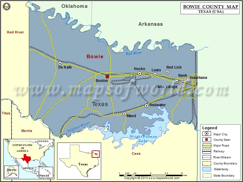
Check this Texas County Map to locate all the state’s counties in Texas Map.
Mountain Peaks in Bowie County
| Mountain Peak/Hill | Elevation [Meter] |
|---|---|
| Adams Hill | 113 |
| Glass Hill | 133 |
| Jim Jones Hill | 117 |
| Rea Hill | 131 |
Airports in Bowie County
| Airport Name |
|---|
| Ashford Field |
| Shilling’s Airport |
Cities in Bowie County
| City | Population | Latitude | Longitude |
|---|---|---|---|
| De Kalb city | 1699 | 33.507524 | -94.616565 |
| Hooks city | 2769 | 33.470678 | -94.284115 |
| Leary city | 495 | 33.468948 | -94.218926 |
| Maud city | 1056 | 33.329892 | -94.346145 |
| Nash city | 2960 | 33.442236 | -94.128244 |
| New Boston city | 4550 | 33.460889 | -94.417911 |
| Red Lick city | 1008 | 33.476675 | -94.168668 |
| Redwater city | 1057 | 33.358555 | -94.255104 |
| Texarkana city | 36411 | 33.448709 | -94.081455 |
| Wake Village city | 5492 | 33.424049 | -94.118707 |
Golf Courses in Bowie County
| Name of Golf Course | Latitude | Longitude |
|---|---|---|
| Northridge Country Club-Texarkana | 33.48194 | -94.060231 |
| Oak Grove Golf Club-New Boston | 33.456841 | -94.336533 |
| Texarkana Golf Ranch-Texarkana | 33.493734 | -94.105926 |
 Wall Maps