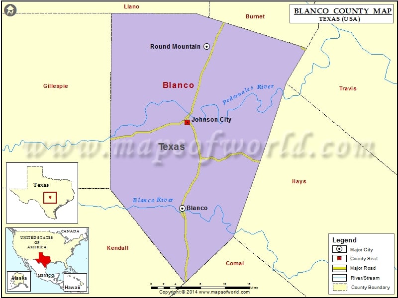
Check this Texas County Map to locate all the state’s counties in Texas Map.
Mountain Peaks in Blanco County
| Mountain Peak/Hill | Elevation [Meter] |
|---|---|
| Big Mountain | 441 |
| Brushy Top | 497 |
| Buffalo Peak | 488 |
| Cave Mountain | 473 |
| Coon Mountain | 459 |
| Howell Mountain | 505 |
| Indian Head | 411 |
| Indian Peak | 494 |
| Long Mountain | 467 |
| Martin Mountain | 546 |
| Monument Hill | 549 |
| Pond Mountain | 437 |
| Rattlesnake Mountain | 494 |
| Round Mountain | 480 |
| Shovel Mountain | 469 |
| Tabletop Mountain | 521 |
| Tater Hill | 512 |
| Twin Sisters | 537 |
Airports in Blanco County
| Airport Name |
|---|
| Bamberger Ranch Airport |
| Blanco Landing Airport |
| Byram Ranch Airport |
| Cross Triangle Ranch Airport |
| Danz Ranch Airport |
| Fall Creek Air Ranch STOLport |
| Harris Ranch Airport |
| Keller Ranch Airport |
| Kennedy Ranch Airport |
| Moursund Ranch Airport |
| Pippen-York Ranch Airport |
| Rocky Top Ranch Airport |
| Tatum Ranch Airport |
| Tierra Linda Ranch Airport |
| West Ranch Airport |
Cities in Blanco County
| City | Population | Latitude | Longitude |
|---|---|---|---|
| Blanco city | 1739 | 30.097696 | -98.42031 |
| Johnson City city | 1656 | 30.274287 | -98.40618 |
| Round Mountain town | 181 | 30.430196 | -98.360377 |
Golf Courses in Blanco County
| Name of Golf Course | Latitude | Longitude |
|---|---|---|
| Vaaler Creek Golf Club-Blanco | 30.042695 | -98.382618 |
National Parks in Blanco County
| Name of Park | Latitude | Longitude |
|---|---|---|
| Lyndon B. Johnson NHP | 30.273331 | -98.414677 |
 Wall Maps