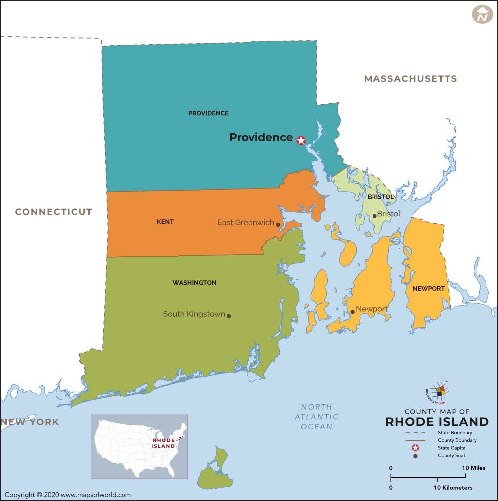
Rhode Island is known as the State of Rhode Island and Providence Plantations. It is a small state in the United States.
About Rhode Island Counties
The state of Rhode Island is made up of five counties. Only Delaware has a lesser number of counties (three). Washington County is also known as South County. Providence, the capital and largest city of the state, is situated in Providence County.
Maps of All Counties of Rhode Island
- Bristol County Map, Rhode Island
- Kent County Map, Rhode Island
- Newport County Map, Rhode Island
- Providence County Map, Rhode Island
- Washington County Map, Rhode Island
 Wall Maps
