- Rhode Island Counties - Rhode island County Map, Map of Rhode Island Cpunties
- Major Cities of Rhode Island -
- Neighbouring States - Massachusetts, Connecticut
- Regional Maps - Map of USA
- Other Rhode Island Maps - Rhode Island Map, Where is Rhode Island, Rhode Island Physical Map, Rhode Island Lat Long Map, Rhode Island Zip Code Map, Rhode Island Area Code Map
Airports in Rhode Island
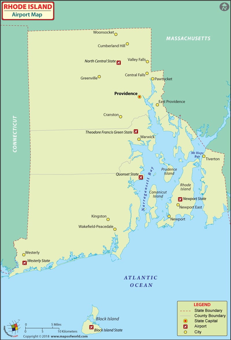
There are 8 airports in Rhode Island for the public to use. There are also numerous private airports in Rhode Island considering its small size. The Rhode Island airports are the gateway to the beautiful tourist spots in the island.
There are no international airports in Rhode Island. The important regional airports in Rhode Island are the Block Island State Airport at Block Island, the Theodore Francis Green Airport at Providence and the Westerly State Airport. Apart from these there are also general aviation and reliever airports such as the Newport State Airport in Newport, the Quonset State Airport in North Kingstown and the North Central Airport in Pawtucket.
The Theodore Francis Green State Airport at Providence is the most active of all the airports in Rhode Island. The airport serves more than five million passengers annually. The airport has many facilities and services for its passengers. It has ATMs, eleven restaurants featuring different flavours of the state and phone facilities spread all over the terminal for the passengers to conveniently use. It has two business centers, for the busy travelers, that come fully equipped with technical support such as speaker phones, photocopiers and fax machines. There is WiFi service available all throughout the airport’s terminals so that the passengers can stay connected all the time. The airport also provides assistance to people with disabilities and offers convenient and accessible areas within the terminal.
The airlines that serve this airport are Air Canada, New England Airlines, Spirit Airlines, Northwest Airlines, American Airlines, United Airlines, Southwest Airlines, Continental Airlines, SATA International, Cape Airlines and Delta Airlines.
One can book the tickets to these airlines online. Some airlines also offer discounts and special fares for the online booking of their tickets.
The other important airports in Rhode Island are at Providence, Kingston, Newport, Westerly, and Block Island.
Maps of Major Airports in Rhode Island
- Westerly State Airport Map
- Block Island State Airport Map
- Newport State Airport Map
- Quonset State Airport Map
List of Airports in Rhode Island |
|---|
| Airport Name | Airport Code | City | Coordinates |
|---|---|---|---|
| Theodore Francis Green State Airport | PVD | Providence / Warwick | 41°43′26″N 071°25′42″W |
| Westerly State Airport | WST | Westerly | 41°20′59″N 071°48′12″W |
| Block Island State Airport | BID | Block Island / New Shoreham | 41°10′05″N 071°34′40″W |
| Richmond Airport | — | Richmond | 41°29′22″N 071°37′14″W |
 Wall Maps