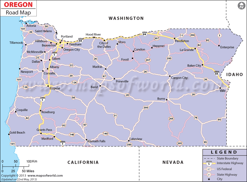
The Oregon Road Map points out the Road Conditions of Oregon with various national ,oregon highway map of the state.
The well developed roadways of Oregon helps in the easy and comfortable connectivity of the state with the other parts of the United States of America. The Oregon State Map clearly indicates the national and state highways running through the state.
The northern part of the state is connected to the southern part of Oregon by Interstate 5. Interstate 84 joins the eastern and the western part of Oregon. The State of Oregon has 66,902 miles of total roads and highways. The good roads of Oregon help in the intra and inter-state connectivity.
According to the official data of 2000, Oregon had 3,091,042 numbers of registered vehicles, out of which 1,541,253 were passenger cars. The Oregon Department of Transportation maintains old roads and builds new roads. The Department formulates various road safety policies for the local inhabitants of the state.
The Oregon Highway Users Alliance, popularly referred to as OHUA, is a non-profitable and private organization that helps in the development of cheap transportation facilities. All the important cities of Salem, Medford, Springfield, Portland and Gresham are well connected by the developed roadways of the state.
 Wall Maps