- Oklahoma Counties - Oklahoma County Map, Map of Oklahoma Counties
- Major Cities of Oklahoma - Oklahoma City
- Neighbouring States - Colorado, Kansas, Arkansas, Missouri, Texas, New Mexico
- Regional Maps - Map of USA
- Other Oklahoma Maps - Oklahoma Map, Oklahoma Physical Map, Oklahoma Airport Maps, Oklahoma Lat Long Map, Oklahoma Zip Code Map, Oklahoma Area COde Map
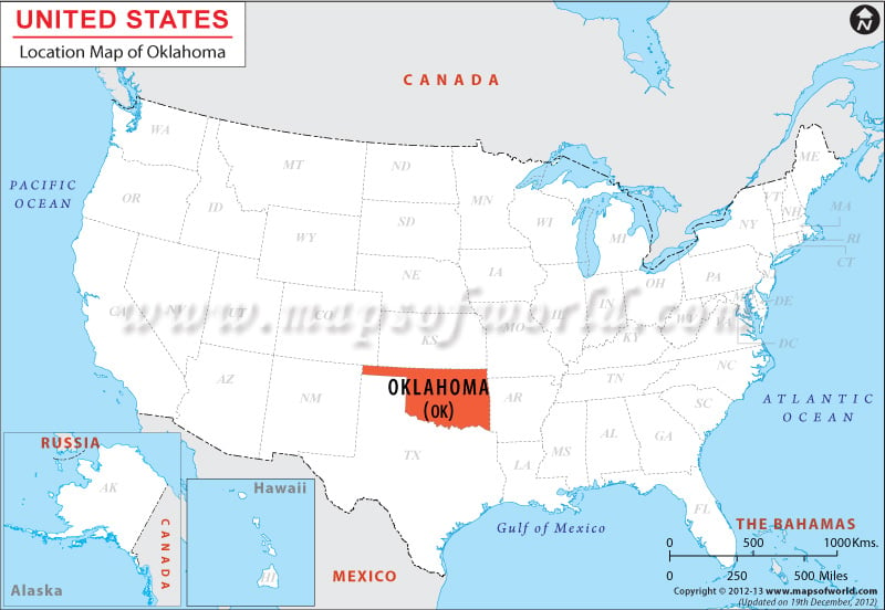
The state of Oklahoma is in the western end of the south-central United States situated at 35.5° N, 98.0° W coordinates.
It is surrounded by Texas from the Southern side, New Mexico from West, Kansas & Colorado from North and Missouri & Arkansas from the Eastern side.
Oklahoma is spread over total area of 112,335 square miles, of which 110,246 square miles of land area and 2,088 square miles of water area. Oklahoma has a 1,577 mile long border.
The state is 463 miles long in its east-west direction and 290 miles long in its north-south direction.
Facts About Oklahoma |
|---|
| State | Oklahoma |
| Country | USA |
| Continent | North America |
| Capital and largest city | Oklahoma City |
| Area | 69,898 sq mi (181,195 km2) |
| Population | 3,878,051 (2014 est) |
| Lat Long | 35° 30′ 0″ N, 98° 0′ 0″ W |
| Official Language | English Cherokee (within Cherokee Nation and UKB) |
| Calling Code | 00 1 405 X |
| Time Zone | Central: UTC -6/-5 |
| Airport | 3- Airports (Commercial Service) |
| Neighbour Countries | Arkansas, Kansas, Missouri, Colorado, New Mexico, Texas |
| Internet TLD | .gov |
| Currency | United States Dollar (USD) |
 Wall Maps