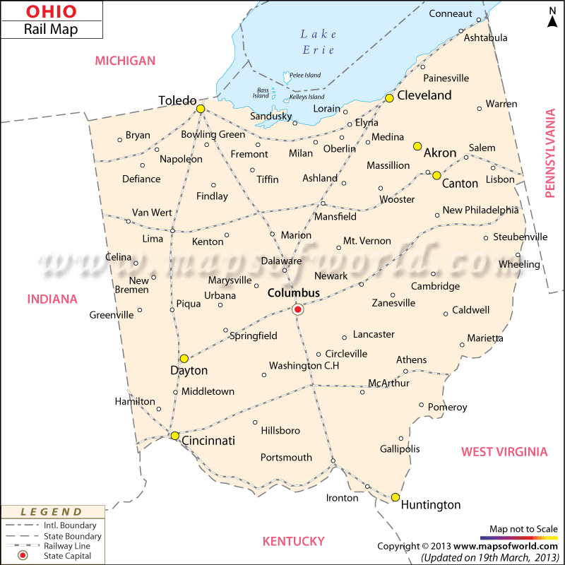
Ohio Railways
The history of railways in Ohio dates back to the year 1844 when Mad River and Lake Erie railroad were built connecting Sandusky and Dayton. Little Miami railroad was constructed in 1846, offering trains to Cincinnati.
In 1907 the interurban railways had 2,809.22 miles of railways in Ohio. According to a survey taken in 2000, Ohio has a total of 4,525.45 miles of train tracks serviced by Class I railroads. Norfolk Southern and CSXT are the major railway service providers of Ohio. While CSXT operates over 3,233 miles of tracks in the state, Norfolk Southern functions over a total of 21,800 miles.
Major towns like Canton, Cleveland, Akron, Dayton, Toledo, Huntington and several others are indicated in the railway map of Ohio. Apart from the state railroads, Ohio is also rich in regional railway organizations such as Wheeling & Lake Erie, Indiana & Ohio, Bessemer & Lake Erie, Ohio Central, Amtrak-Lake Shore Line, Three Rivers, Cardinal and Capitol Limited. These companies offer passenger lines. Railway routes linking nearby and distant areas of the state can be found in the Ohio state map as well.
 Wall Maps