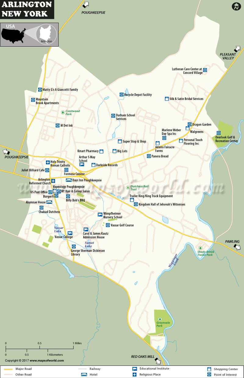
Arlington Map written by: shivebroacc Arlington Map
Arlington, located in Dutchess County, New York, the United States, is a census-designated place (CDP). A CDP refers to the centralization of the population for statistical purposes only as defined by the United States Census Bureau. The town of Poughkeepsie houses Arlington and it is a suburb of the neighboring Poughkeepsie city.
Most notable locations in Arlington include; Arlington speedway, Vassar Golf Course, Powerhouse Theater, and Frances Lehman Loeb Art center, Doubleday Studio Art and Class of 1951 observatory among many others.
Geography of Arlington
Arlington is located in Latitude 41.69 N and Longitude 73.89 W in the north-central part of the town of Poughkeepsie. The city of Poughkeepsie borders Arlington to the west. The Census-designated place has a total area of 0.66 square miles (1.7 kilometers square) as per the United States Census Bureau.
The map provided shows the locations of various areas in reference to each other. Apart from that, the various locations can be viewed in terms of their accessibility to various infrastructures within the Arlington area. The various infrastructures depicted on the map include roads, railroads, such as, hotels, shopping centers such as Dutchess Shopping Center, parks and other recreational facilities, water bodies such as Sunset Lake, churches such as Kingdom Hall of Jehovah Witnesses and educational institutions, financial institutions such as Ulster Savings Bank among others.
As we have learned over the years, the infrastructure within an area usually influences the distribution of the population. From the map, it is possible to note how the settlement of human population is concentrated mostly along major roads and proximity to other crucial infrastructure and services. For example the South western part of the map is more populated in comparison to the South Eastern side.
Most importantly, also on the map are the cardinal directions important in geography; south, north, east and west. The use of these directions is crucial in helping to orient our position or location for that matter.
IW09.03.2017
 Wall Maps
