- New Hampshire Counties - New Hampshire County Map, Map of New Hampshire Counties
- Major Cities of New Hampshire - Concord
- Neighbouring States - Maine, Massachusetts, Vermont
- Regional Maps - Map of USA
- Other New Hampshire Maps - New Hampshire Map, Where is New Hampshire, New Hampshire Physical Map, New Hampshire Lat Long Map, New Hampshire Zip Code Map, New Hampshire Area Code Map
Airports in New Hampshire
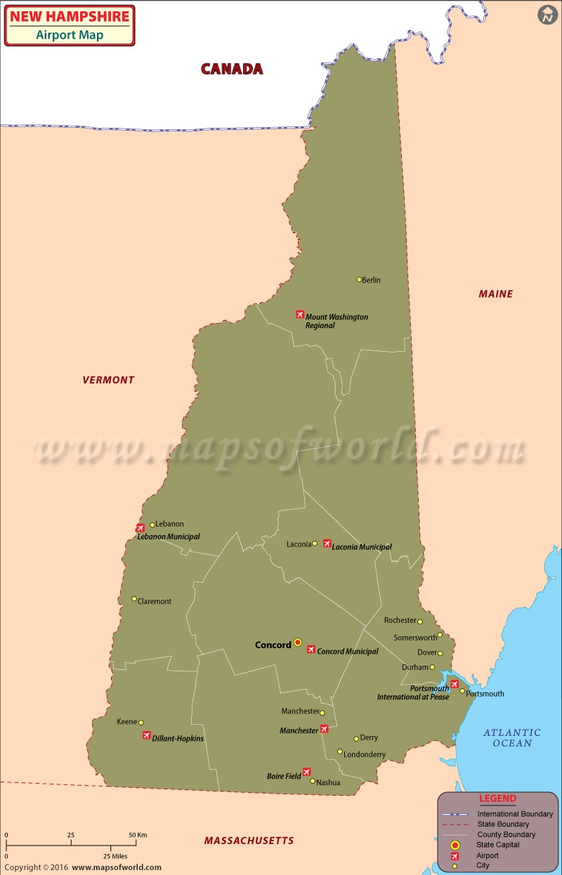
There are 26 public airports in New Hampshire. Pease International Tradeport Airport is only one international airport in New Hampshire.
Pease International Tradeport Airport at Portsmouth, the only international airport in New Hampshire, is the state’s gateway to the international community. The airport offers hangar facilities for private fliers, too. This airport in New Hampshire also has a trade port, which is useful for import and export businesses. The airlines that operate from the premises of this airport are Lebanon Municipal Airport at Lebanon and the Manchester-Boston Regional Airport at Manchester.
Tickets to these airlines can be booked online. Online ticket booking can earn special fares and discounts from some of these airlines.
The New Hampshire airports receive many tourists each year and, as a result, there are many car rental, hotel, and bus services to be found within or immediately outside the airport.
The important airports in New Hampshire are at Colebrook, Berlin, Lancaster, Twin Mountain, Glen, Woodsville, Plymouth, Rochester, Newport, Nashua, and Brattleboro.
Maps of Major Airports in New Hamshire
List of Airports in New Hampshire |
|---|
| Airport Name | City | Coordinates |
|---|---|---|
| Lebanon Municipal Airport | Lebanon | 43°37′34″N 072°18′15″W |
| Manchester-Boston Regional Airport | Manchester | 42.9325, -71.435556 |
| Portsmouth International Airport at Pease | Portsmouth | 43°04′41″N 070°49′24″W |
| Alton Bay Seaplane Base | Alton Bay | 43°28′39″N 071°14′13″W |
| Franconia Airport | Franconia | 44°11′45″N 71°44′58″W |
| Gorham Airport | Gorham | 44°23′35″N 71°11′48″W |
| Hawthorne-Feather Airpark | Deering | 43°03′41″N 071°54′19″W |
 Wall Maps