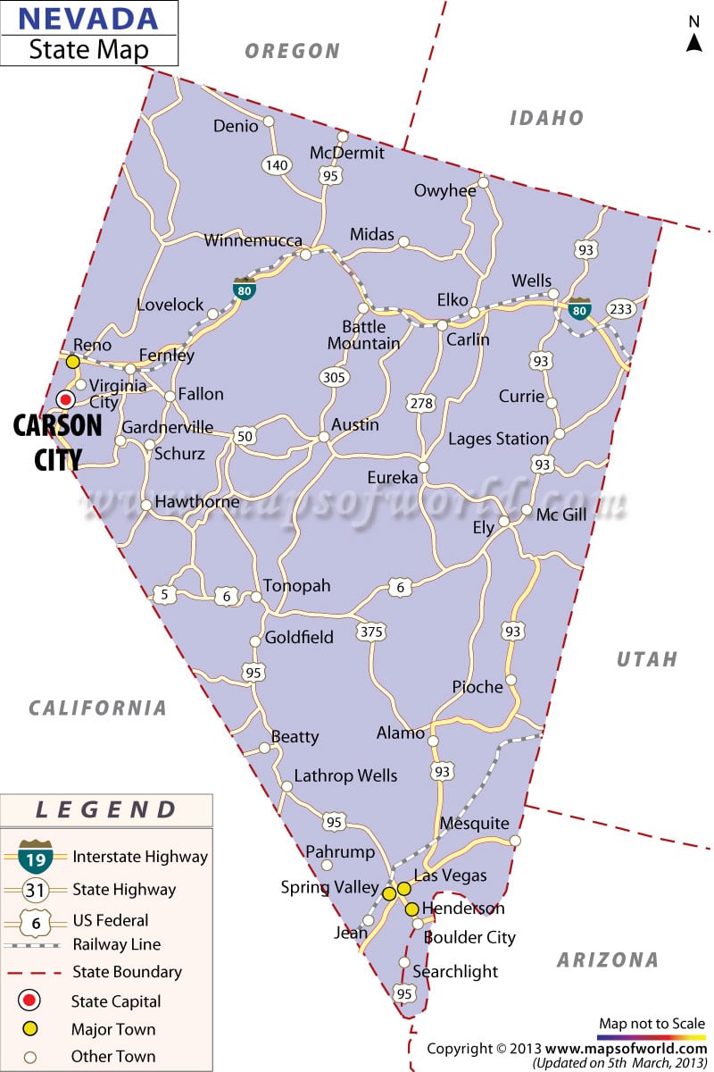
Nevada occupies a total area of 110,561 square miles and is the seventh largest state in the United States. The Nevada Map highlights the major towns, highways, cities, railway routes, and roads of the state. The map of Nevada also points out the other nearby states.
Cities including Boulder, Fallon, Henderson, Elko, Mesquite, Wells, Yerrington, Pahrump, Crystal Bay, Sparks, Central Sierra, Fernley, and Reno are prominently marked on the map of Nevada. Carson City, the state capital, is also vividly marked on the Nevada Map.
The Nevada state map is an important indicator of the commercially viable areas of the state. Nevada boasts of a flourishing economy because of the revenue earned from chemical manufacturing, pet food, and communication and agriculture equipment industries.
Travelers who are visiting the state for the first time can get a range of information on the rail routes and roads from the Nevada map. Also, the map depicts some of the politically and historically significant zones of the state. As a whole, the Nevada Map acts as a vital tool that facilitates the understanding of the diversified features of the state.
 Wall Maps