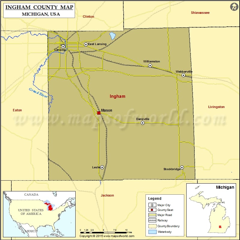
Mountain Peaks in Ingham County
| Mountain Peak/Hill | Elevation [Meter] |
|---|---|
| Teaspoon Hill | 320 |
Airports in Ingham County
| Airport Name |
|---|
| Eichmeier Field |
| Ingham Medical Helistop |
| Jerome County Airport |
| Jet Pad Heliport |
| Lakeside Airport |
| Maidens Airport |
| Mason Jewett Field |
| Michigan National Guard Headquarters Heliport |
| Sawyer Field |
| Sparrow Hospital Heliport |
Cities in Ingham County
| City | Population | Latitude | Longitude |
|---|---|---|---|
| Dansville village | 563 | 42.555765 | -84.302979 |
| East Lansing city | 48579 | 42.74838 | -84.483414 |
| Edgemont Park | 2358 | 42.746747 | -84.592639 |
| Haslett | 19220 | 42.752462 | -84.401877 |
| Holt | 23973 | 42.641637 | -84.530782 |
| Lansing city | 114297 | 42.709071 | -84.558447 |
| Leslie city | 1851 | 42.450581 | -84.433185 |
| Mason city | 8252 | 42.580536 | -84.442714 |
| Okemos | 21369 | 42.705802 | -84.413335 |
| Stockbridge village | 1218 | 42.448297 | -84.175642 |
| Webberville village | 1272 | 42.664032 | -84.178588 |
| Williamston city | 3854 | 42.683629 | -84.283671 |
 Wall Maps