Mountain Peaks in Berrien County
| Mountain Peak/Hill | Elevation [Meter] |
|---|---|
| Great Warren Dune | 198 |
| Mount Edward | 243 |
| Mount Fuller | 223 |
| Mount Randall | 243 |
| Pikes Peak | 232 |
| Tower Hill | 245 |
More Maps of Berrien County
Airports in Berrien County
| Airport Name |
|---|
| Andrews University Airpark |
| Benedick Airport |
| Del Hickcox Airport |
| Hancock Airport |
| Merrihew Airport |
| Myers Airport |
| Ranken Airport |
| Southwest Michigan Regional Airport |
| Watervliet Municipal Airport |
| Wolverton’s Field |
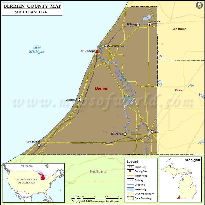
Cities in Berrien County
| City | Population | Latitude | Longitude |
|---|---|---|---|
| Baroda village | 873 | 41.954116 | -86.487924 |
| Benton Harbor city | 10038 | 42.116038 | -86.448414 |
| Benton Heights | 4084 | 42.121104 | -86.413739 |
| Berrien Springs village | 1800 | 41.947426 | -86.340453 |
| Bridgman city | 2291 | 41.939656 | -86.565203 |
| Buchanan city | 4456 | 41.828363 | -86.365486 |
| Coloma city | 1483 | 42.1865 | -86.308327 |
| Eau Claire village | 625 | 41.984202 | -86.303574 |
| Fair Plain | 7631 | 42.082519 | -86.452018 |
| Galien village | 549 | 41.801592 | -86.499565 |
| Grand Beach village | 272 | 41.774583 | -86.788403 |
| Lake Michigan Beach | 1216 | 42.21258 | -86.375977 |
| Michiana village | 182 | 41.763726 | -86.811087 |
| New Buffalo city | 1883 | 41.792143 | -86.742115 |
| New Troy | 497 | 41.878985 | -86.547413 |
| Niles city | 11600 | 41.834682 | -86.24717 |
| Paw Paw Lake | 3511 | 42.211352 | -86.275863 |
| Shoreham village | 862 | 42.060438 | -86.511429 |
| Shorewood-Tower Hills-Harbert | 1344 | 41.881718 | -86.614027 |
| St. Joseph city | 8365 | 42.099013 | -86.487927 |
| Stevensville village | 1142 | 42.013879 | -86.524296 |
| Three Oaks village | 1622 | 41.79891 | -86.612384 |
| Watervliet city | 1735 | 42.188367 | -86.257829 |
 Wall Maps