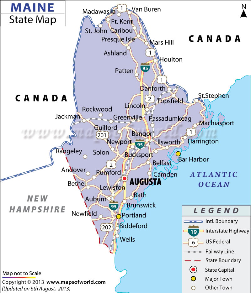
Maine encompasses total area of 35,387 square miles, out of which 30,865 square miles is the total land area and 4,523 square miles is the inland water area. Situated at an altitude of 5,276 feet, Mount Katahdin is the highest point of Maine. The Atlantic Ocean is the lowest point of the state of Maine. Kennebec River, St. John River, Androscoggin River and Penobscot River are the major rivers of the State of Maine.
Richardson Lake and Moosehead Lake are the prominent lakes of Maine. The geographical divisions of the mountains, piedmont, uplands and coastal lowlands characterize the heterogeneous topography of the state. The map of Maine indicates the important cities of the state.
Augusta is the capital of the State of Maine. Caribou, Bangor, Lewiston, Kennebunk, Cape Elizabeth and South Berwick are some of the prominent cities of Maine. The Maine State Map points out the exact geographical location of the state.
 Wall Maps