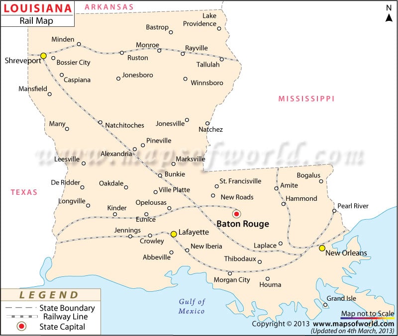
This map points out the railway routes through the state of Louisiana.
The Pontchartrain Railroad formed in the year 1831 and was the first railway in Louisiana.
Mainly served by Class I tracks, the state of Louisiana was equipped with 3,184 miles of railway tracks in 2000.
Amtrak is a prominent railway service provider within the state. The City of New Orleans, Crescent, Cardinal and Sunset Limited offer regular train service through Louisiana.
In addition to providing in-state service, Amtrak provides service to New York, Chicago and Los Angeles.
Among the towns connected via the train routes of the state are:
Jennings, New Orleans, Lafayette, Bunkie, Shreveport, Baton Rouge, Hammond, New Roads, Kinder, Ferriday, Winnfield and Slidell.
 Wall Maps