- Kentucky Counties - Kentucky County Map, Map of Kentucky Counties
- Major Cities of Kentucky - Lexington
- Neighbouring States - West Virginia, Virginia, Tennessee, Missouri, Illinois, Indiana, Ohio
- Regional Maps - Map of USA
- Other Kentucky Maps - Kentucky Map, Kentucky Physical Map, Kentucky Airports Map, Kentucky Lat Long Map, Kentucky Zip Code Map, Kentucky Area Code Map, Kentucky National Parks Map
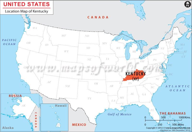
Where is Kentucky on the map of USA
Kentucky United States Map showing Kentucky’s location which is situated in the eastern part of the south central USA within the coordinates 37.5° N, 85.0° W, Kentucky occupies a total area of 40,409 sq mi, and encompasses a total land area of 39,669 sq mi, with a total inland water area of 740 sq mi. The state of Kentucky is surrounded by Illinois, Ohio, and Indiana on its northern side, by West Virginia on its northeastern side, by Virginia on its southeastern side, Tennessee on its southern side, and by Missouri on its western side.
Facts About Kentucky |
|---|
| State Name | Kentucky |
|---|---|
| Country | USA |
| Continent | North America |
| Capital | Frankfort |
| Largest city | Louisville |
| Area | 40,409 sq mi (104,659 km2) |
| Population | 4,413,457 (2014 est) |
| Lat Long | 37° 30′ 0″ N, 85° 0′ 0″ W |
| Official Language | English |
| Calling Code | +1 502 |
| Time Zone | Eastern: UTC −5/−4 (eastern half), Central: UTC −6/−5 (western half) |
| Airport | 5- Airports Scheduled service |
| Neighbour State | Illinois, Indiana, Missouri, Ohio, Tennessee, Virginia, West Virginia |
| Internet TLD | .ky |
| Currency | United States dollarb (USD) |
 Wall Maps