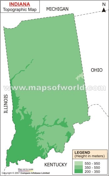
River Ohio at 98 meter is the lowest point of the state. Northern Indiana falls under the watershed drainage zone of St. Lawrence. The rest of the state falls in the watershed area of River Mississippi. River Wabash flows in the western direction through north-central Indiana and drains into Ohio, Tippecanoe, Eel, Mississinewa and White rivers. The Maumee River flows across the northern part of the state and drains into River Kankakee and Lake Erie. The State of Indiana has several lakes. Some of the important lakes of the state are Lake Michigan, Lake Mississinewa, Lake Monroe and Lake Patoka. West Baden and French Lick of the Orange County are known for the natural springs which are full of minerals. The layers of rock beneath the surface of earth of the Indiana region are made up of sediment deposits of the Paleozoic era. The Indiana State Map shows the heterogeneous topography of the state.
Indiana Topographic Map
The physiographic divisions of the state are clearly indicated in the Indiana Topographic Map. The northern part of Indiana is represented by undulating lands, while the southern part is represented by rough mountains. Franklin Township of Wayne County, at 383 meter is the highest point of Indiana.
