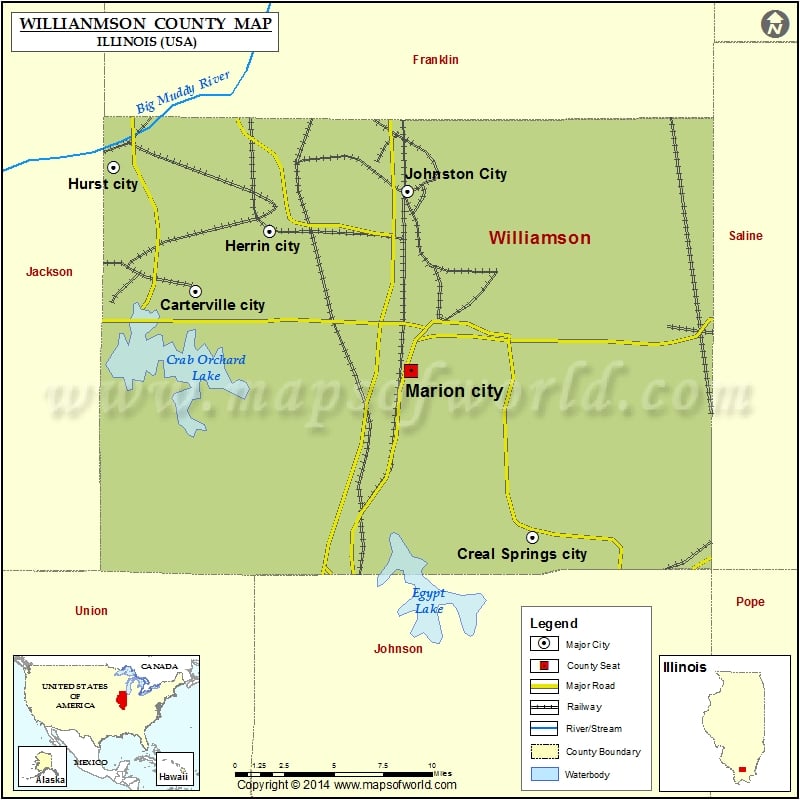
Mountain Peaks in Williamson County
| Mountain Peak/Hill | Elevation [Meter] |
|---|---|
| McKinney Hill | 156 |
More Maps of Williamson County
Airports in Williamson County
| Airport Name |
|---|
| Fabick Five Heliport |
| Heartland Regional Medical Center Heliport |
| Herrin Hospital Heliport |
| Va Medical Center Heliport |
| Williamson County Regional Airport |
Cities in Williamson County
| City | Population | Latitude | Longitude |
|---|---|---|---|
| Bush village | 275 | 37.842705 | -89.129512 |
| Cambria village | 1228 | 37.780076 | -89.11884 |
| Carterville city | 5496 | 37.762981 | -89.083864 |
| Colp village | 225 | 37.807429 | -89.078599 |
| Crab Orchard | 333 | 37.724989 | -88.805872 |
| Crainville village | 1254 | 37.750463 | -89.06101 |
| Creal Springs city | 543 | 37.619785 | -88.837449 |
| Energy village | 1146 | 37.774232 | -89.024676 |
| Freeman Spur village | 287 | 37.861132 | -88.999263 |
| Herrin city | 12501 | 37.798216 | -89.030161 |
| Hurst city | 795 | 37.835085 | -89.144292 |
| Johnston City city | 3543 | 37.821277 | -88.928751 |
| Marion city | 17193 | 37.716374 | -88.926771 |
| Pittsburg village | 572 | 37.777071 | -88.849943 |
| Spillertown village | 203 | 37.764127 | -88.919722 |
| Whiteash village | 241 | 37.785369 | -88.92931 |
Golf Courses in Williamson County
| Name of Golf Course | Latitude | Longitude |
|---|---|---|
| Chawnee Golf Club-Marion | 37.714516 | -88.902479 |
| Crab Orchard Golf Club-Carterville | 37.760094 | -89.091594 |
| Hickory Ridge Public Golf Ctr-Carbondale | 37.68624 | -89.142233 |
| Kokopelli Golf Club-Marion | 37.754329 | -88.964525 |
| Lake of Egypt Country Club-Marion | 37.611499 | -88.949923 |
| Pine Lakes Golf Course-Herrin | 37.767402 | -89.026457 |
| Star Dust Golf Course-Johnston City | 37.810435 | -88.951023 |
 Wall Maps