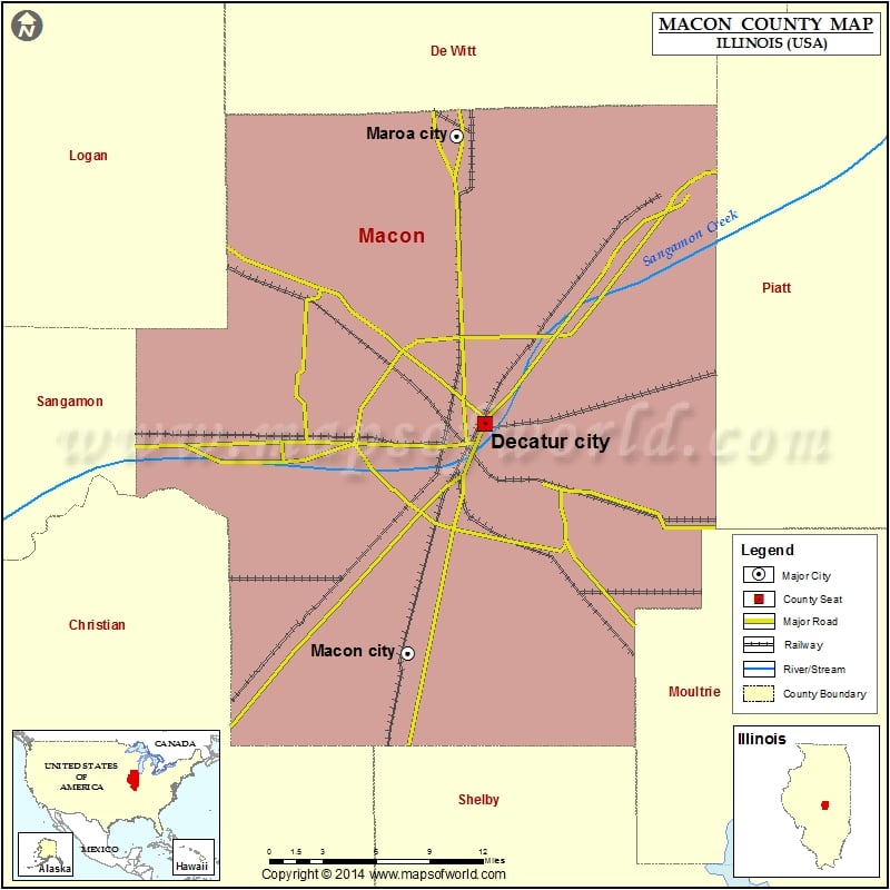
Mountain Peaks in Macon County
| Mountain Peak/Hill | Elevation [Meter] |
|---|---|
| Blue Mound | 211 |
More Maps of Macon County
- Macon County Map, Alabama
- Macon County Map, North Carolina
- Macon County Map, Tennessee
- Macon County Map, Georgia
Airports in Macon County
| Airport Name |
|---|
| Corman Acres Airport |
| Cribbet Airport |
| Decatur Airport |
| Decatur Conference Center and Hotel Heliport |
| Decatur Memorial Hospital Heliport |
| Hayenga’s Cant Find Farms Airport |
| Public Service Company/Mdc Heliport |
| Snow Airport |
| St Mary’s Hospital – Decatur Heliport |
Cities in Macon County
| City | Population | Latitude | Longitude |
|---|---|---|---|
| Argenta village | 947 | 39.985126 | -88.820149 |
| Blue Mound village | 1158 | 39.700543 | -89.118573 |
| Boody | 276 | 39.76549 | -89.047239 |
| Decatur city | 76122 | 39.855582 | -88.933698 |
| Forsyth village | 3490 | 39.926134 | -88.964136 |
| Harristown village | 1367 | 39.843018 | -89.06146 |
| Long Creek village | 1328 | 39.805234 | -88.847405 |
| Macon city | 1138 | 39.711347 | -88.996464 |
| Maroa city | 1801 | 40.036407 | -88.956274 |
| Mount Zion village | 5833 | 39.779133 | -88.882928 |
| Niantic village | 707 | 39.854369 | -89.164871 |
| Oreana village | 875 | 39.936886 | -88.869448 |
| Warrensburg village | 1210 | 39.931761 | -89.061867 |
Golf Courses in Macon County
| Name of Golf Course | Latitude | Longitude |
|---|---|---|
| Country Club of Decatur-Decatur | 39.844548 | -88.88805 |
| Hickory Point Golf Course-Forsyth | 39.923688 | -88.967437 |
| Nelson Park Golf Course-Decatur | 39.841088 | -88.921366 |
| Red Tail Run Golf Club-Decatur | 39.804478 | -88.964137 |
| Scovill Golf Club-Decatur | 39.842982 | -89.017144 |
| South Side Country Club-Decatur | 39.80399 | -88.961609 |
 Wall Maps