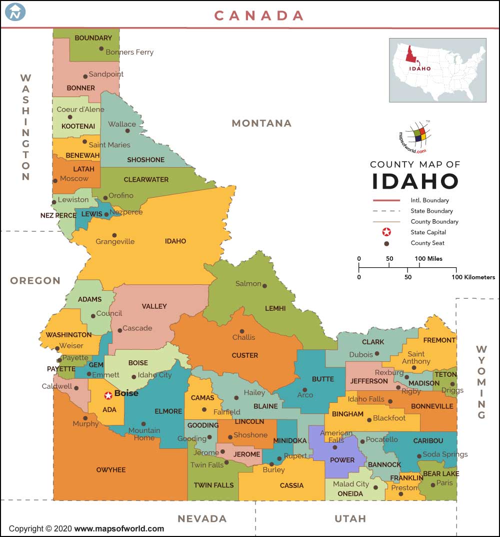
Idaho, the 43rd state of the United States, is a big state in the northwestern part of the country. The capital of this landlocked state is Boise, which is also the biggest city of the state. The state is made up of 44 counties, which function as its administrative divisions.
About Idaho County Map
Since 1919, Idaho is home to 44 counties and their areas vary from 8,502 to 410 square miles (22,020 to 1,062 sq km). All these counties are governed by their respective county seats. An Idaho County Map shows all the counties in the state along with the bordering states, which are Nevada, Wyoming, Utah, Oregon, Montana, and Washington. Given below are some of the important counties in the state along with their population and other major details:
List of Counties in Idaho |
|---|
| County Name | Population (2016) | Area (sq. mi.) |
|---|---|---|
| Ada County Map | 444,028 | 1054.99 |
| Adams County Map | 3,900 | 1364.58 |
| Bannock County Map | 84,377 | 1113.3 |
| Bear Lake County Map | 5,945 | 971.38 |
| Benewah County Map | 9,092 | 776.07 |
| Bingham County Map | 45,201 | 2094.73 |
| Blaine County Map | 21,791 | 2644.78 |
| Boise County Map | 7,124 | 1902.46 |
| Bonner County Map | 42,536 | 1737.67 |
| Bonneville County Map | 112,232 | 1868.48 |
| Boundary County Map | 11,681 | 1268.81 |
| Butte County Map | 2,501 | 2232.85 |
| Camas County Map | 1,072 | 1074.96 |
| Canyon County Map | 211,698 | 589.72 |
| Caribou County Map | 6,887 | 1766.01 |
| Cassia County Map | 23,504 | 2566.45 |
| Clark County Map | 860 | 1764.63 |
| Clearwater County Map | 8,497 | 2461.4 |
| Custer County Map | 4,096 | 4925.45 |
| Elmore County Map | 26,018 | 3077.57 |
| Franklin County Map | 13,406 | 665.43 |
| Fremont County Map | 12,943 | 1866.76 |
| Gem County Map | 17,184 | 562.58 |
| Gooding County Map | 15,185 | 730.78 |
| Idaho County Map | 16,156 | 8484.88 |
| Jefferson County Map | 27,839 | 1095.08 |
| Jerome County Map | 22,994 | 599.84 |
| Kootenai County Map | 154,311 | 1245.12 |
| Latah County Map | 39,196 | 1076.65 |
| Lemhi County Map | 7,723 | 4564.16 |
| Lewis County Map | 3,853 | 479.04 |
| Lincoln County Map | 5,271 | 1205.53 |
| Madison County Map | 39,048 | 471.52 |
| Minidoka County Map | 20,616 | 759.62 |
| Nez Perce County Map | 40,369 | 849.08 |
| Oneida County Map | 4,343 | 1200.33 |
| Owyhee County Map | 11,389 | 7677.98 |
| Payette County Map | 23,026 | 407.52 |
| Power County Map | 7,654 | 1405.57 |
| Shoshone County Map | 12,452 | 2633.91 |
| Teton County Map | 10,960 | 450.36 |
| Twin Falls County Map | 83,514 | 1925.03 |
| Valley County Map | 10,496 | 3677.82 |
| Washington County Map | 10,172 | 1456.32 |
All the 44 counties in Idaho symbolize a powerful podium of governance at regional levels. Details about the situation of the counties are available from the Idaho state map as well.
 Wall Maps