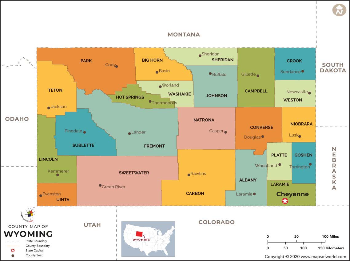
Wyoming County Map locates the 23 counties of the state. Highlighting the exact geographical standing of all the 23 counties, the county map of Wyoming helps in offering a clear view of the political sub-divisions of the state. Some of the counties of Wyoming state are mentioned below with total population (according to census 2000):
All the counties within the geographical premises of Wyoming strengthen the local-level governance. All the counties of Wyoming state are governed by respective administrative units called county seats. While some of the county seats were established in the 1800s, some others were formed in the 1900s. The Wyoming state map facilitates the clear understanding of the geographical position of all the counties of the place.

 Wall Maps