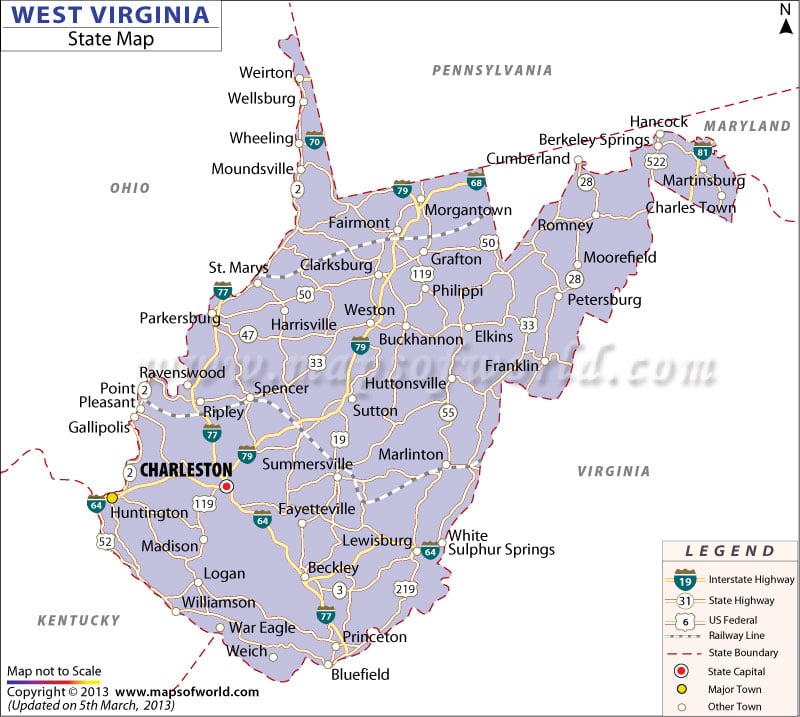
About West Virginia Map:
West Virginia State map highlights the neighboring states, important towns, major roads, railways line, national highways and the state capital. West Virginia State map clearly denotes that Pennsylvania, Ohio, Kentucky, Virginia and Maryland are the 5 states bordering it. NH 64, NH 70, NH 77 and NH 79 are the 4 main national highways passing through the state of West Virginia.
Charleston, the capital is also the largest and the most prominent city of West Virginia. Some of the major cities indicated in the West Virginia State map are Huntington, Parkersburg, Morgantown, Wheeling, Fairmont, Sutton, Beckley and Princeton.

 Wall Maps