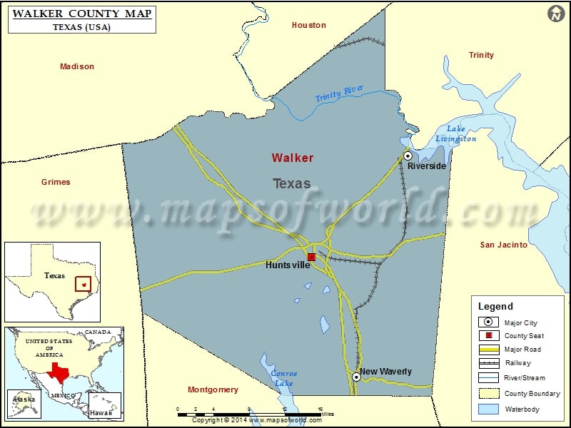
Check this Texas County Map to locate all the state’s counties in Texas Map. Mountain Peaks in Walker County Mountain Peak/Hill Elevation [Meter] Blue Bonnet Hill 96 Gospel Hill 92 Peckerwood Hill 144…
Check this Texas County Map to locate all the state’s counties in Texas Map.
Mountain Peaks in Walker County
| Mountain Peak/Hill |
Elevation [Meter] |
| Blue Bonnet Hill |
96 |
| Gospel Hill |
92 |
| Peckerwood Hill |
144 |
| Smith Hill |
126 |
More Maps of Walker County
Airports in Walker County
| Airport Name |
| Estates Airpark |
| Huntsville Memorial Hospital Heliport |
| Huntsville Municipal Airport |
| Jordan Ranch Airport |
Cities in Walker County
| City |
Population |
Latitude |
Longitude |
| Huntsville city |
38548 |
30.704869 |
-95.554412 |
| New Waverly city |
1032 |
30.537377 |
-95.48227 |
| Riverside city |
510 |
30.847288 |
-95.398191 |
Golf Courses in Walker County
| Name of Golf Course |
Latitude |
Longitude |
| Country Campus Golf Course-Huntsville |
30.71364 |
-95.565148 |
| Elkins Lake Rec. Assoc.-Huntsville |
30.667214 |
-95.523068 |
| Raven Nest Golf Club-Huntsville |
30.701605 |
-95.559342 |
| Waterwood National Resort & Country Club-Huntsville |
30.79011 |
-95.511606 |

 Wall Maps