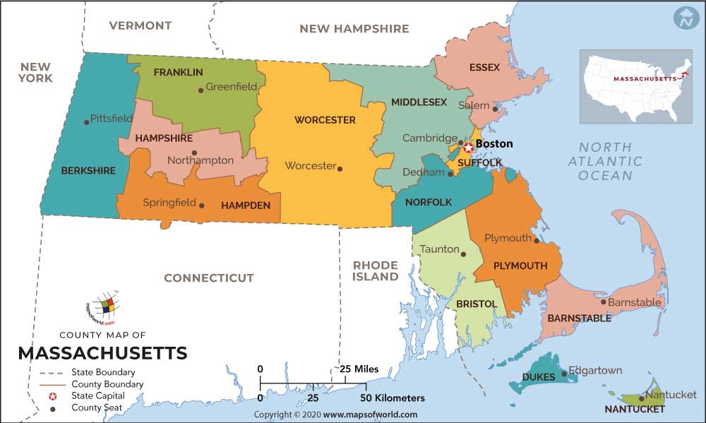
Massachusetts County Map accurately demarcates the geographical position of all the 14 counties of Massachusetts. Massachusetts County, have a total of 50 cities and 301 towns in them.
Middlesex County indicated on the Massachusetts County map, is the most populous county of the state. Suffolk County on the Massachusetts County map is the county where the state capital Boston is located. Essex County, Middlesex County and Suffolk Country are the three oldest counties of Massachusetts and were created in the year 1643.
Most of the Massachusetts County indicated on the Massachusetts County map, have no county government of their own and hence these counties are merely geographical regions. Worcester County with an area of 1,579 square miles is the largest country by area indicated on the Massachusetts County map.

 Wall Maps