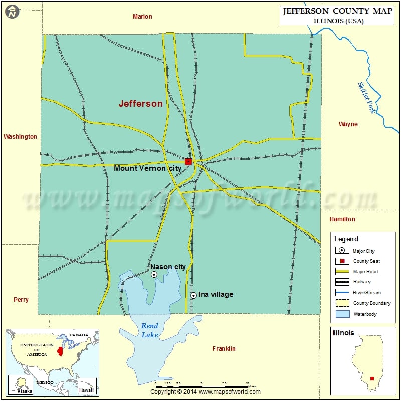
Jefferson County Map, Illinois
Mountain Peaks in Jefferson County Mountain Peak/Hill Elevation [Meter] Lowry Hill 180 The Pinnacle 152 More Maps of Jefferson County Jefferson County Map, Wisconsin Jefferson County Map, Nebraska Jefferson County…
Mountain Peaks in Jefferson County
Mountain Peak/Hill
Elevation [Meter]
Lowry Hill
180
The Pinnacle
152
More Maps of Jefferson County
Airports in Jefferson County
Airport Name
Big Muddy Correctional Facility Heliport
Crossroads Community Hospital Heliport
Davy Jones /Private/ Airport
Good Samaritan Regional Health Care Center Heliport
Mount Vernon Airport
Prairie Airport
Cities in Jefferson County
City
Population
Latitude
Longitude
Belle Rive village
361
38.231742
-88.739175
Bluford village
688
38.325649
-88.735533
Bonnie village
397
38.202756
-88.906945
Dix village
461
38.443149
-88.942305
Ina village
2338
38.14952
-88.904031
Mount Vernon city
15277
38.315943
-88.913005
Nason city
236
38.175975
-88.966213
Opdyke
254
38.258236
-88.789857
Waltonville village
434
38.214042
-89.037362
Woodlawn village
698
38.327864
-89.034716
Golf Courses in Jefferson County
Name of Golf Course
Latitude
Longitude
Crooked Creek Golf Links-Mount Vernon
38.381333
-89.006244
Green Hills Country Club-Mount Vernon
38.329192
-88.863802
Indian Hills Golf Course-Mount Vernon
38.327959
-88.928489

 Wall Maps