
 Wall Maps
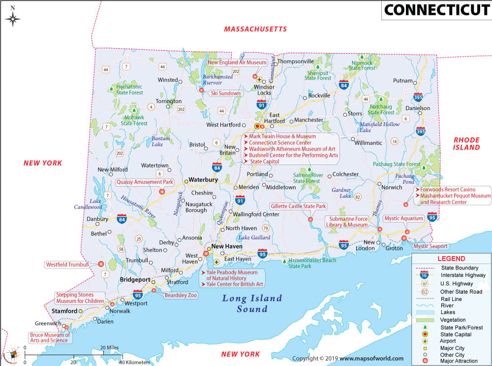
Explore this Connecticut map to know everything you want to know about the forty-eighth state of the US in terms of area. Learn about Connecticut’s location in the United States of America. Look at its geography, time zones, history, major cities, name of the capital/most significant city, area/zip codes, flag/seal, national parks, trails, frequently asked questions (FAQs), etc.
About Connecticut
In the United States, Connecticut is the third smallest state. On January 9, 1788, it was admitted to the Union. Hartford is Connecticut’s capital city, the state’s fourth largest city, and a metropolitan area. Although English is the official language in Connecticut, people also speak Spanish and French. Connecticut is the 29th most populous state in the US.
The US state of Connecticut has many nicknames, such as:
- Constitution State (official)
- The Nutmeg State
- The Provisions State
- The Land of Steady Habits
“Qui Transtulit Sustinet, “is the State Motto for Connecticut, which means “He Who Transplanted Still Sustains.” Check Key Facts of Connecticut to learn more about this US state.
Connecticut Flag
The flag of Connecticut was adopted on September 9, 1897. The flag has a baroque shield with three grapevines, each bearing three bunches of purple grapes. The background is an azure blue field. The banner below the shield has Connecticut’s motto.
Connecticut’s coat of arms is the 1711 seal of the colony that was Connecticut then. The three grapevines are believed to symbolize the colonies of Connecticut, New Haven, and Saybrook.
Connecticut State Symbols
On March 24, 1931, the General Assembly of Connecticut adopted the state’s official coat of arms design.
Connecticut’s official shield is a rococo design. It has a white field having three grapevines in the center, which are shown to bear fruits. Below is a white streamer with clefts at each end. Two fine lines outline the clefts. The motto is written in solid letters of a medium bold Gothic font. The coat of arms has appeared on the state flag since 1887.
Learn more exciting aspects of the State from Connecticut Facts & Trivia.
Connecticut Location
The Connecticut Location Map shows the exact location of the US state of Connecticut on the United States map. This map shows the US state’s boundaries, neighboring countries, and oceans.
The State of Connecticut is situated in the southern New England region of the United States. It has:
- Massachusetts (to the north)
- Long Island (to the south)
- Rhode Island (to the east)
- New York (to the west)
Connecticut’s coordinates are 40°58′ N to 42°03′ N Latitude and 71°47′ W to 73°44′ W Longitude. Check the Connecticut Longitude and Latitude Map to learn more about the location.
Connecticut Time Zones
The time zone in Connecticut is UTC– 05:00 (Eastern), and its summer (DST) is UTC– 04:00 (EDT).
Connecticut Geography
Connecticut is spread across an area of 5543.2 sq mi (14,357 sq km). It is the 48th largest state in the United States in terms of size.
Connecticut has five specific land regions:
- Taconic Section: The Appalachian Mountains range cut from northwestern Connecticut to western Massachusetts. The range has many important summits, among which Mount Equinox (Vermont) and Mount Greylock (Massachusetts) have the highest peaks.
The Taconic has over hundreds of miles of trails, including segments from the 3,500 km Appalachian Trail. Taconic in Native American means “in the trees.”
- Western New England Uplands: The New England Uplands run from central Connecticut via east-central Massachusetts, western Rhode Island, eastern Vermont, and southern New Hampshire before ending in northern Maine, exactly south of the US’s border with Québec and New Brunswick in Canada.
These uplands are a geomorphic subsection. It is not a distinct system of mountain ranges. The contour is hilly and not mountainous.
- The Connecticut Valley Lowland: This region mostly has a north-south orientation. It runs from the coast, via central Connecticut, between Massachusetts, into the corners of Vermont and New Hampshire, meeting them at their borders. There is also a tiny, fragmented portion of this region in the Pomperaug valley in western Connecticut.
- The Eastern New England Uplands: The Eastern Upland mirrors the Western. This is also a hilly region washed out by many rivers. Their valleys unite to give birth to the Thames River. The Thames reaches Long Island Sound in New London. Altitudes here seldom reach above 1,300 feet (400 m). In both the Eastern and Western uplands, the peaks of the hills appear to be even and have been prepared for agriculture.
- The Coastal Lowlands extend almost 100 miles from west to east. They include the whole southern chunk of Connecticut along the Long Island Sound. The coastal lowlands have rocky peninsulas and sand and gravel beaches. Shallow bays and salt meadows are also present. Check this Connecticut Topographic Map to learn more.
Learn about the location of mountains, rivers, lakes, the state’s capital, state boundary, ocean, and neighboring states from this Physical Map of Connecticut.
Connecticut History
Connecticut started as three specific settlements of Puritans. They came from Massachusetts and England and united under one royal charter in 1663.
The settlements grew affluent from the trade and agriculture of its people, mainly ethnic English Protestants. Connecticut came to be popularly known as the “land of steady habits” because of its inhabitants, who were very conservative politically, socially, and even from a religious standpoint.
The main churches of this land were the Congregational and Unitarian churches. Connecticut had an influential role to play in the American Revolution. Eventually, it became the center of the conservative, business-minded Constitutionalism Federalist Party.
The word “Connecticut” comes from the French distortion of the Algonkian word quinetucket, meaning “beside the long, tidal river.”
In 1636, Rev. Thomas Hooker and Rev. Samuel Stone led around 100 people to establish the settlement of Hartford. Rev. Stone was born in Hertford, England, hence the name. Thomas Hooker, “the Father of Connecticut,” was a strong personality in the initial growth of New England as a colony.
Hooker was one of the most prodigious preachers among his contemporaries. He was a knowledgeable writer on Christian subjects. He was also the first minister of Cambridge, Massachusetts, and one of its initial settlers. Hooker founded the city of Hartford as well as the state of Connecticut.
Connecticut had a prominent part in the country’s industrial revolution. A number of its factories became famous for advanced machinery. In education and intellectual discourses, Yale College led the way.
The college had scholars like Noah Webster and writers like Mark Twain. This famous writer lived in Connecticut and established a deep connection with the Mississippi River.
The settlers landed in Connecticut from eastern and southern Europe at the beginning of the twentieth century. In the 21st century, this state has famous for its jet engines, nuclear submarines, and advanced pharmaceuticals.
Connecticut Counties
Connecticut has eight counties. Suffolk County is the largest county, having a total area of 2372.9 sq mi (6,146 sq km). Tolland County is the smallest county, having a total area of 416.9 sq mi (1080 sq km). Check the Connecticut County Map to learn more about the counties.
Connecticut Area Codes
Connecticut has four area codes:
The Connecticut Area Codes Map helps you locate a particular area code. You can also use it to learn more about the area code boundary, county and state boundaries, and state capital.
Connecticut Zip Codes
There are 277 active zip codes in Connecticut. Some of the state’s best zip codes to live in include 06103, 06119, 06033, and many more. You can locate a particular zip code’s location, boundary, state boundary, and state capital with the help of the Connecticut Zip Codes Map.
Connecticut Major Cities
Learn about the state’s major cities from this Connecticut cities map. It also helps you to know the exact location of the state capital, other cities, state boundaries, neighboring states and oceans, and many more.
Connecticut’s most prominent cities are Bridgeport, New Haven, Hartford, Stamford, Norwalk, Danbury, New Britain, and Waterbury. Check out the Connecticut Cities Map for more details.
Connecticut Airports
The busiest airport in Connecticut is the Hartford Bradley International Airport. Other major airports in the state are Danielson, Groton-New London, Hartford-Brainard, Waterbury-Oxford, and Windham. Check the location of different airports in the state on the Connecticut Airports Map. This map also shows Connecticut’s state and country boundaries, cities, the state capital, neighboring states, and oceans.
Connecticut National Park and Trails
Connecticut has two National Parks with an annual visitor count of 25,430. The major national parks in Connecticut are Washington-Rochambeau Revolutionary Route, Weir Farm National Historical Park, and many more.
In Connecticut, you can enjoy 1,775 trails (hiking, backpacking, mountain biking, and other adventurous trails). These trails or routes run through highlands and lowlands, challenging and easy terrains. Some of the best trails are Bear Mountain Trail, Ragged Mountain Blue, Red Blazed Loop, Sleeping Giant Tower Trail, etc.
Check out the US National Parks Map to get a clear idea about the locations of different national parks, monuments, preserves, etc.
Connecticut Climate
The north of Connecticut has typically cold winters with medium snowfall and hot, sweaty summers. As you move towards the far south and coastal region, you will encounter cool winters with a blend of rain and intermittent snow. You will also face the long, hot, sticky summers in the middle and lower East Coast.
- Fall: During October’s first week, the northwest and northeast of Connecticut have peak fall foliage. The effects of the season gradually reach the south before finally residing on the southern shores. The first week of November usually sees the last remnants of this beautiful season.
- Spring: After the snow melts, spring descends quickly on Connecticut. Gardens become colorful with the blossoming of flowering trees. Spring festivals are held quite regularly, and it is time for people to enjoy the open air. The spring months in Connecticut are April and May.
- Summer: Summers are hot, sultry, and usually distressing. In July and August, the highest temperatures during the day average north of 80°F. Thunderstorms are a routine affair in summer, often assuming dangerous proportions. The season of storms is between late June and September.
- Winter: In Connecticut, winters are genuinely cold. During the day, highs hardly cross 40°F along the coast and average around 86°F in the northwest region between December and February. It usually snows in the northwest and sporadically along the southern coast. January is the coldest month.
FAQs on Connecticut
FAQ #1: What Time Zone Is Connecticut?
Ans: The time zone in Connecticut is UTC– 05:00 (Eastern). Its summer (DST) is UTC– 04:00 (EDT).
FAQ #2: Where is Connecticut?
Ans: Connecticut is in the northeast corner of the United States.
FAQ #3: Is Connecticut A Red State?
Ans: No, Connecticut is a Blue state. Here, Joe Biden won by 20 points, a healthy increase over Hillary Clinton’s 13 points in 2016.
FAQ #4: What Is Connecticut Known For?
Ans: Connecticut is known for its many firsts : (a) Hamburger (b) Polaroid camera (c) Helicopter (d) Color television (e) nuclear submarine. It is also famous for its beautiful Fall foliage and Yale University. Check out these places to visit in Connecticut.
FAQ #5: What Is The Capital Of Connecticut?
Ans: Hartford is the capital of Connecticut
FAQ #6: What Planting Zone Is Connecticut?
Ans: In Connecticut, the planting zone ranges from 5 to 7
FAQ #7: How Is The Appalachian Mountains Connected To Connecticut?
Ans: To the west of Connecticut are the Appalachian Mountains, which run north, crisscrossing the state into Massachusetts.
FAQ #8: What Is The Population Of Connecticut?
Ans: The population of Connecticut in 2022 is estimated to be 3.6 million.
FAQ #9: Who Is The Governor Of Connecticut?
Ans: Democrat Ned Lamont or Edward Miner Lamont Jr. is the current governor of Connecticut. He is Connecticut’s 89th governor. He assumed office on January 9, 2019.
FAQ #10: What Is The Most Common Animal In Connecticut?
Ans: Eastern gray squirrel is the most common animal in Connecticut. Its scientific name is Sciurus carolinensis, the largest squirrel found here.