- Alabama Counties - Alabama County Map, Counties in Alabama
- Major Cities - Birmingham, Mobile City, Montgomery
- Neighbouring States - Tennessee, Georgia, Mississippi, Florida
- Regional Maps - Map of USA
- Other Alabama Maps - Alabama Map, Map of Alabama Cities, Alabama Physical Map, Alabama Airports Map, Alabama Lat Long Map, Alabama Zip Code Map, Alabama Area Code Map, Alabama National Parks Map
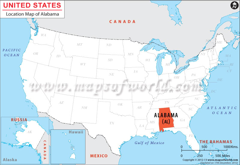
Where is Alabama
Alabama is situated between latitude 30°13′ N to 35° North of the Equator and longitude 84°51′ W to 88°28′ West of Greenwich Meridian.
Alabama shares its border with Mississippi in the west, Georgia in the east, the Gulf of Mexico and Florida in the south, and Tennessee in the north.
Facts About Alabama |
|---|
| State | Alabama |
|---|---|
| Country | USA |
| Continent | North America |
| Capital | Montgomery |
| Largest city | Birmingham |
| Area | 52,419 sq mi (135,765 km2) |
| Population | 4,849,377 (2014 est.) |
| Lat Long | 32° 42′ 0″ N, 86° 42′ 0″ W |
| Official Language | English |
| Time Zone | Central: UTC −6/−5 (most of state) Eastern: UTC −5/−4 (Phenix City, Alabama area) |
| Airport | 6-Airports (Commercial Service) |
| Neighbor Countries | Florida, Georgia, Mississippi, Tennessee |
| Currency | United States Dollar (USD) |
Related Maps
 Wall Maps