Congress created Hot Springs Reservation in 1832 to protect thermal springs that had become renowned for their supposed therapeutic properties. By the time it became the 19th national park in 1921, Hot Springs had grown into a popular spa, attracting vacationers as well as patients seeking a cure for all sorts of illnesses. Hot Springs also became the spring-training home for several major league baseball teams, whose players used the thermal baths to relax after workout and training sessions.
Water that fell as rain more than 4,000 years ago flows from the Earth here at an average temperature of 143°F, having been heated at a depth of more than a mile below ground before rising back to the surface. Most of the natural hot springs have been diverted into pipes flowing to hotels and to a line of spa buildings known as Bathhouse Row. The eight remaining bathhouses on the row were built between 1892 and 1923 and display a rich diversity of architectural styles.
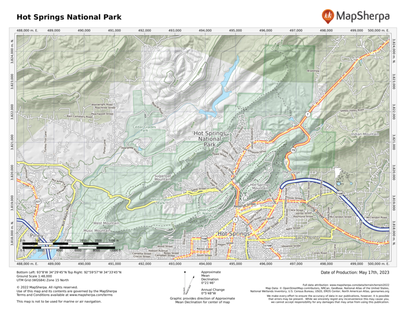
The park’s 5,550 acres encompass wooded uplands of the Ouachita Mountains, crisscrossed by 26 miles of hiking trails. Unusual for North American mountains, the Ouachitas run east–west instead of north–south, pushed up in parallel folds by an ancient collision of tectonic plates.
Note: The official name of the city adjacent to the park is Hot Springs National Park. This means that many local businesses can legally say they are “in Hot Springs National Park,” or imply that they are affiliated with the national park (in the federal National Park Service sense) when they are not.
How to Visit
The park can be experienced in a day, though hikers might want to spend more time here. Tour the park museum in the 1915 Fordyce Bathhouse to learn what “taking the waters” was all about. Then stroll along Bathhouse Row and the Grand Promenade to imagine the scene at the height of the bathing era.
Hike or drive up Hot Springs Mountain or West Mountain for views of the city of Hot Springs in the valley below and national park land on surrounding mountains. Then hike one or more of the many trails. Afterward, ease tired muscles by taking a traditional bath, either on Bathhouse Row or in one of the hotels that use natural spring water.
Useful Information
How to get there
From Little Rock (55 miles east), take I-30 southwest 27 miles and then continue 28 miles on U.S. 70 and U.S. Bus. 70.
When to go
Year-round, although late spring and fall are the most pleasant seasons. Summers can be hot and crowded with vacationers visiting nearby lakes. The city is also quite busy during the early spring horse-racing season.
Visitor Center
The Fordyce Bathhouse Visitor Center, 369 Central Avenue, is open daily.
Headquarters
101 Reserve Street Hot Springs, AR 71901 nps.gov/hosp 501-620-6715
Camping
The Gulpha Gorge campground (44 sites), on Gorge Road on the east side of the park, available daily on a first-come, first-served basis. There is no backcountry camping in the park, but the nearby Ouachita National Forest offers many campgrounds and primitive camping options.
Lodging
Lodging is plentiful in Hot Springs. Hot Springs Convention and Visitors Bureau (hotsprings.org; 501-321-2835, 800-SPA-CITY).
US National Parks Map
About the Guide


