M6.0 earthquake hits Peru |
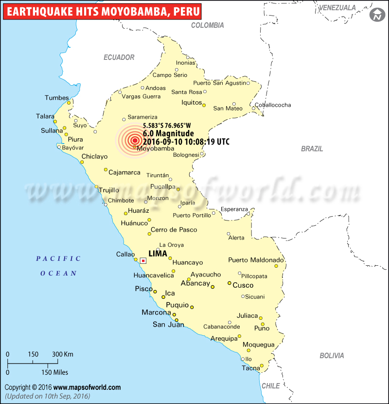 |
Earthquakes in Peru - Map showing the location of all major earthquakes occurred in Peru. |
M5.4 earthquake hits Peru, 15 Aug 2016 02:58:59 UTC |
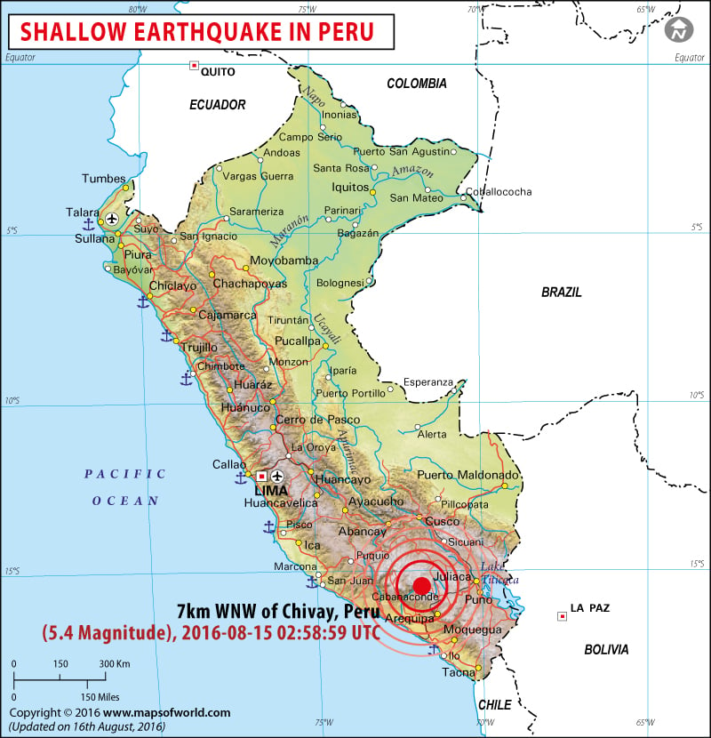 |
Earthquake in Peru - Map showing the epicenter of M5.4 earthquake in Peru. |
M7.5 earthquake hits Peru, 24 Nov 2015 22:45:38 UTC |
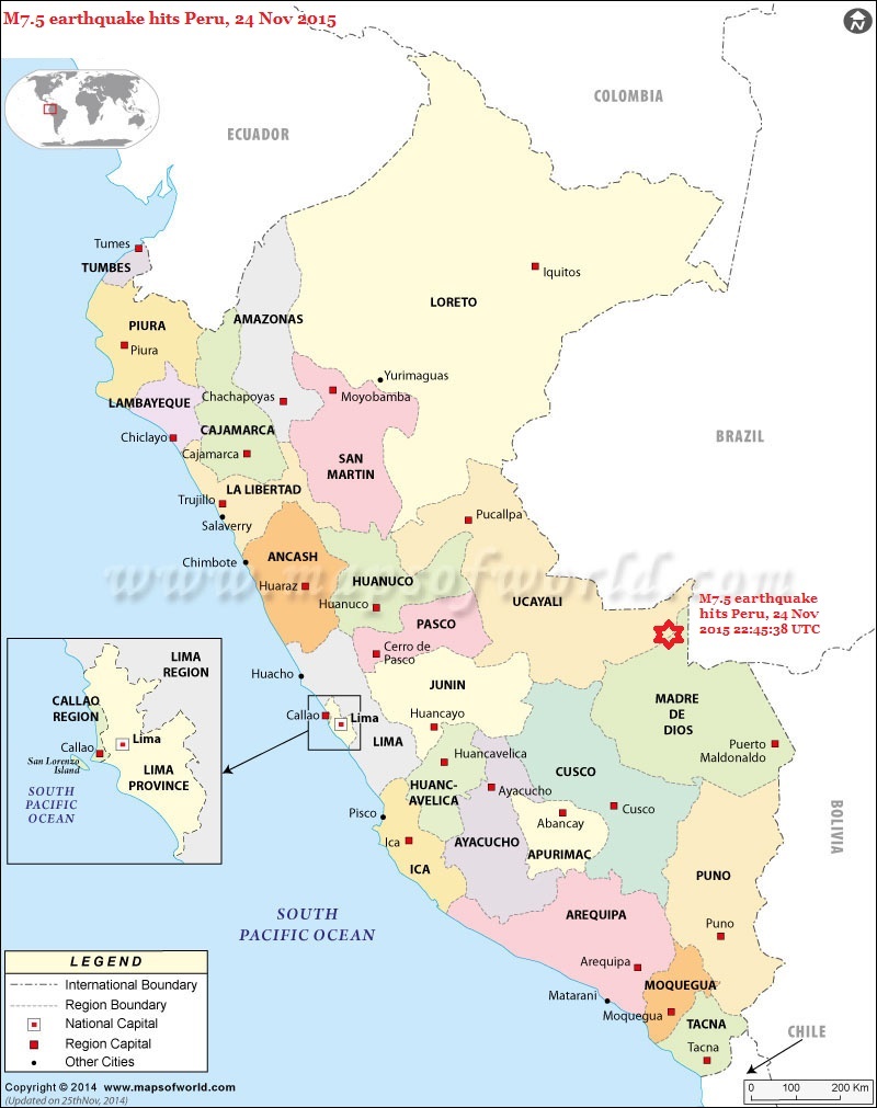 |
Map showing the epicenter of M7.5 earthquake in Peru. |
Historic Earthquakes in Peru |
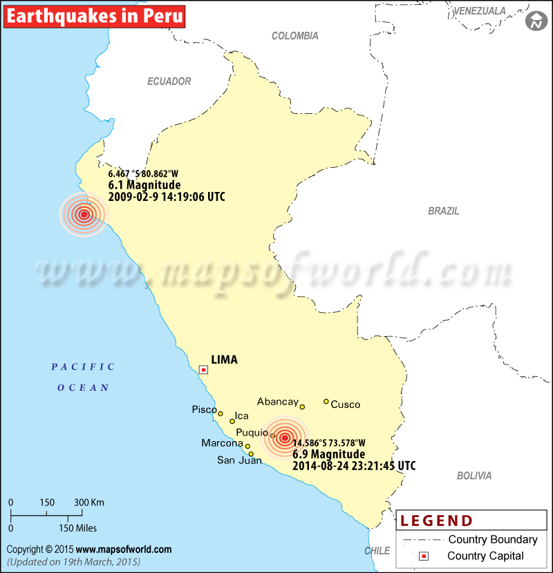 |
Map showing the epicentre of all major earthquake in Peru. |
Earthquakes in Peru
M6.3 earthquake hits Peru
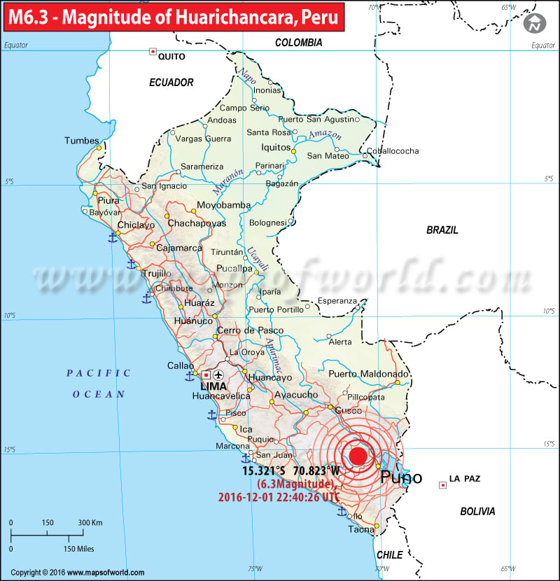
| Description :Earthquakes in Peru - Map showing the location of all major earthquakes occurred in Peru. |
| Disclaimer |
Earthquake Hits Peru
2016-12-01 22:40:26 UTC: A sparsely populated area of southern Peru has been hit by a shallow earthquake of 6.3 magnitude on Thursday. According to the U.S. Geological Survey, the epicenter of the quake was around 26 miles (43 kilometers) north-northeast of Huarichancara in Puno region of Peru.
As per reports, the quake was felt in provinces of San Roman, Melgar and Lampa. However, there is no report of any injury or damage.
Earthquate with 6.0M Rocks Northern Peru
2016-09-10 10:08:19 UTC: An earthquake measuring 6.0 on the Richter scale has hit northern Peru in the early morning around 1008 GMT. As per the US Geological Survey report, the epicenter is believed to be in a rainforest about 30 miles northeast of a Moyobamba—capital of the San Martín region. No immediate casualties or damage has been reported after the tremors.
Also View:
5.4-magnitude earthquake hits Peru: Four dead
2016-08-15 02:58:59 UTC: A 5.4-magnitude earthquake struck Peru killing four people and injuring 68 others. A US tourists was among those killed in the earthquake. According to media reports, the earthquake, which rocked Peru late on Sunday, destroyed about 50 homes in the southern Arequipa region. The earthquake also cut off roads and disrupted power in the region. A military plane was pressed into service to provide around 7.5 tonnes of food for more than 1,200 people who were affected by the disaster.
M7.5 earthquake - 169km WNW of Iberia, Peru
November 24, 2015 22:45 UTC M 7.5 earthquake was the first of two similarly sized events near the Peru-Brazil border in southeast Peru.
| Distance | Location |
|---|---|
| 169km (105mi) | WNW of Iberia, Peru |
| 239km (149mi) | WNW of Cobija, Bolivia |
| 241km (150mi) | WNW of Brasileia, Brazil |
| 264km (164mi) | S of Tarauaca, Brazil |
| 688km (428mi) | ENE of Lima, Peru |
Remote jungle region in Peru hit by 7.5 magnitude earthquake
Nov 25, 2015 - A jungle region located near the border of Peru, Bolivia and Brazil has been hit by a 7.5 magnitude earthquake. The earthquake’s epicenter was 107 miles from Iberia in Madre de Dios region of Peru and it had a depth of 374 miles, the U.S. Geological Survey reported. So far, there have been no reports of injuries or damages. The sparsely populated jungle region is inhabited by around 1000 people.
Preliminary Earthquake Report
| Magnitude | 7.5 |
|---|---|
| Date-Time | 24 Nov 2015 22:45:38 UTC , 24 Nov 2015 17:45:38 near epicenter , 25 Nov 2015 02:45:38 standard time in your timezone |
| Location | 10.585S 70.966W |
| Depth | 602 km |
| Distances | 173 km (107 mi) WNW of Iberia, Peru, 245 km (151 mi) WNW of Cobija, Bolivia, 247 km (153 mi) W of Brasileia, Brazil, 268 km (166 mi) S of Tarauaca, Brazil, 81 km (422 mi) ENE of Lima, Peru |
| Location Uncertainty | Horizontal: 8.8 km; Vertical 7.4 km |
| Parameters | Nph = 123; Dmin = 369.0 km; Rmss = 1.06 seconds; Gp = 44° Version = |
| Event ID | us 100040ww |
| Earthquakes in Peru | |||
| Date | Location | Magnitude | Fatalities |
|---|---|---|---|
| Feb 14, 1619 | Trujillo, Peru | M 7.7 | Fatalities 350 |
| May 12, 1664 | Ica, Peru | M 7.3 | Fatalities 400 |
| Oct 20, 1687 | Lima, Peru | M 8.5 | Fatalities 600 |
| Oct 28, 1746 | Lima, Peru Fatalities 5,000 | ||
| Jul 10, 1821 | Camana, Peru | M 8.2 | Fatalities 162 |
| Aug 13, 1868 | Arica, Peru (now Chile) | M 9.0 | Fatalities 25,000 |
| Dec 12, 1908 | Off the Coast of Central Peru | M 8.2 | |
| Nov 4, 1913 | Abancay, Peru Fatalities 150 | ||
| May 24, 1940 | Callao, Peru | M 8.2 | Fatalities 249 |
| Aug 24, 1942 | Off the coast of central Peru | M 8.2 | Fatalities 30 |
| Jan 30, 1943 | Yanaoca, Peru Fatalities 200 | ||
| Nov 10, 1946 | Ancash, Peru | M 7.3 | Fatalities 1,400 |
| Nov 1, 1947 | Satipo, Peru | M 7.3 | Fatalities 233 |
| May 11, 1948 | Moquegua, Peru | M 7.4 | Fatalities 70 |
| May 21, 1950 | Cusco, Peru | M 6.0 | Fatalities 83 |
| Dec 12, 1953 | Tumbes, Peru | M 7.4 | Fatalities 7 |
| Jan 15, 1958 | Arequipa, Peru | M 7.3 | Fatalities 28 |
| Jan 13, 1960 | Arequipa, Peru | M 7.5 | Fatalities 57 |
| Oct 17, 1966 | Near the Coast of Peru | M 8.1 | Fatalities 125 |
| Jun 19, 1968 | Moyobamba, Peru | M 6.9 | Fatalities 46 |
| Oct 1, 1969 | Comas region, Chile | M 6.4 | Fatalities 136 |
| May 31, 1970 | Chimbote, Peru | M 7.9 | Fatalities 66,000 |
| Oct 3, 1974 | Near the Coast of Central Peru | M 8.1 | |
| Jun 23, 2001 | Near the Coast of Peru | M 8.4 | Fatalities 138 |
| Jul 7, 2001 | Near the Coast of Peru | M 7.6 | Fatalities 1 |
| Sep 26, 2005 | Northern Peru | M 7.5 | Fatalities 5 |
| Oct 20, 2006 | Near the Coast of Central Peru | M 6.7 | |
| Aug 15, 2007 | Near the Coast of Central Peru | M 8.0 | Fatalities 514 |
