- Neighboring Countries - Papua New Guinea
- Continent And Regions - Oceania Map
- Other Solomon Islands Maps - Solomon Islands Map, Solomon Islands Blank Map, Solomon Islands Cities Map, Solomon Islands Flag
Solomon Islands
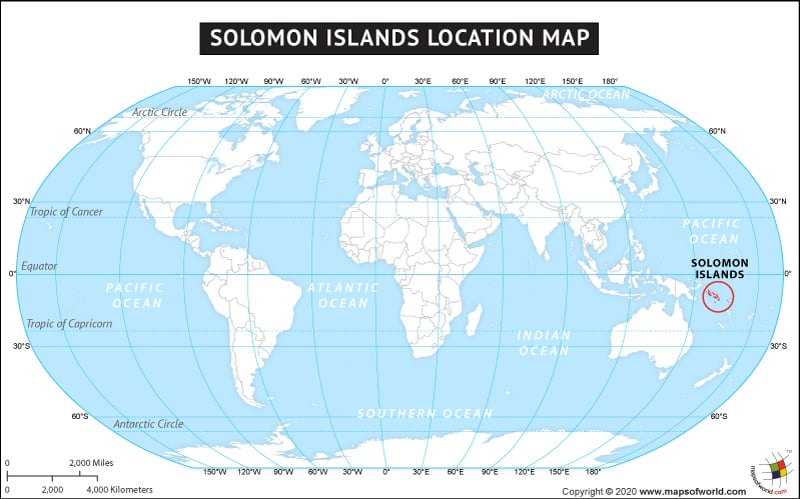
A collection of thousand islands in Oceania that form a sovereign country are called the Solomon Islands covering a land area of 28,400 square kilometres. These islands lie about 2033 kms to the east of Papua New Guinea.
The country of Solomon Islands is in the Oceania continent and the latitude and longitude for the country are 8.9389° S, 159.5305° E.
The neighboring countries of Solomon Islands are :
Maritime Boundaries
- country
- Australia
- Papua New Guinea
- Vanuatu
- New Caledonia
Facts About Solomon Islands |
| Island Name | Solomon Islands |
|---|---|
| Continent | Oceania |
| Country | NA |
| Capital and largest city | Honiara |
| Area | 28,400 km2 (10,965 sq mi) |
| Population | 523,000 (2009 Est.) |
| Lat Long | 9.4667° S, 159.8167° E |
| Official Language | English |
| Calling Code | +677 |
| Time Zone | (UTC+11) |
| Airport | 24-Airports Scheduled Service |
| Neighbour Countries | Vanuatu, Australia, Papua New Guinea, Federated States of Micronesia |
| Internet TLD | .sb |
| Currency | Solomon Islands dollar (SBD) |

 Solomon Islands Facts