10K
- Poland Cities - Bialystok, Bielsko Biala, Bydgoszcz, Bytom, Chorzow, Czestochowa, Dabrowa Gornicza, Elblag, Gdansk, Gdynia, Gliwice, Gorzow Wielkopolski, Jaworzno, Katowice, Kielce, Krakow, Legnica, Lubin, Miedzyrzec Podlaski, Olsztyn, Opole, Plock, Poznan, Radom, Ruda Slaska, Rybnik, Rzeszow, Sierpc, Slupsk, Sosnowiec, Suwalki, Szczecin, Torun, Tychy, Wadowice, Walbrzych, Warsaw, Wielun, Wloclawek, Wroclaw, Zabrze, Zielona Gora
- Poland Provinces - Dolnoslaskie, Kujawsko-Pomorskie, Lodzkie, Lubelskie, Lubuskie, Malopolskie, Mazowieckie, Opolskie, Podkarpackie, Podlaskie, Pomorskie, Slaskie, Swietokrzyskie, Warminsko-Mazurskie, Wielkopolskie, Zachodniopomorskie
- Neighboring Countries - Slovakia, Czech Republic, Germany, Belarus, Lithuania
- Continent And Regions - Europe Map
- Other Poland Maps - Poland Map, Poland Blank Map, Poland Road Map, Poland Rail Map, Poland River Map, Poland Political Map, Poland Physical Map, Poland Flag
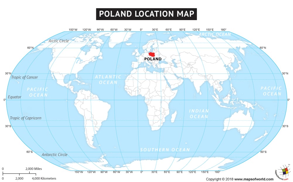
The country of Poland is on the Europe continent and the latitude and longitude of Poland are 52° N and 20° E.
The neighboring countries of Poland are :
- Belarus
- Czech Republic
- Lithuania
- Slovakia
- Ukraine
- Russia
- Germany
Maritime Boundaries
| Facts About Poland |
|---|
| Country Name | Poland |
|---|---|
| Continent | Europe |
| Capital and largest city of Poland | Warsaw |
| Area | 312,679 km2 (120,696.41 sq mi ) Water (%) 3.07 |
| Population of Poland | 39.9 million |
| Lat Long of Poland | 52° N and 20° E |
| Official Language | Polish |
| Calling Code | 48 |
| Time Zone | CET (UTC+1) Summer (DST) CEST (UTC+2) |
| Airports in Poland | 15 Airports in Poland |
| Neighbor countries of Poland | Ukraine, Russia, Germany, Czech Republic, Lithuania, Belarus, Slovakia |
| Internet TLD | .pl |
| Currency | Polish złoty |

 Poland Climate