- Neighboring Countries - Belgium, Luxembourg, Germany, France, United Kingdom
- Continent And Regions - Europe Map
- Other Netherlands Maps - Netherlands Map, Netherlands Blank Map, Netherlands Road Map, Netherlands Rail Map, Netherlands River Map, Netherlands Cities Map, Netherlands Political Map, Netherlands Physical Map, Netherlands Flag
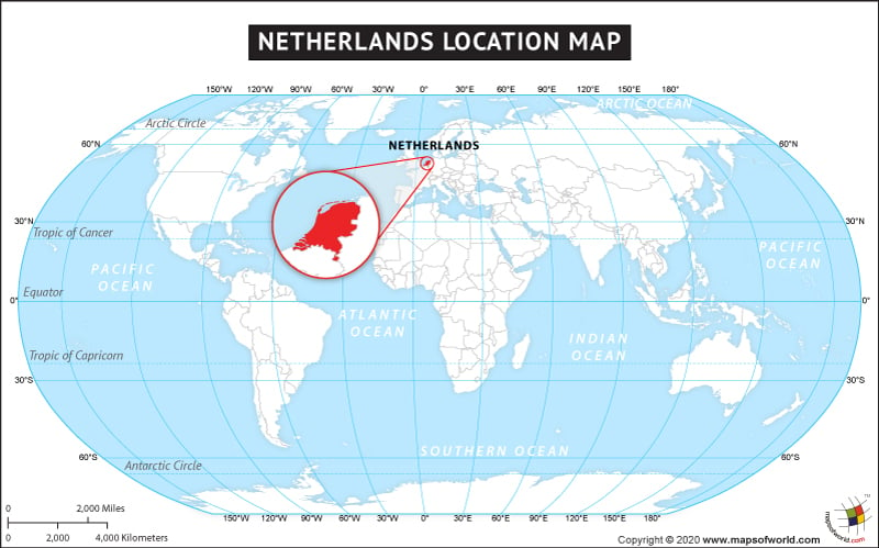
The Kingdom of Netherlands, commonly called as the Netherlands is located in the western part of Europe. It is bordered by the North Sea in the north and west and its land boundary is shared with Belgium and Germany in the south and to the east respectively. This geographically mostly low lying country is situated between 52° 23′ N latitudes and 4° 55′ E longitudes. It is the one hundred and thirty fifth largest country of the world with the total area of 41,543 sq. km. The capital and largest city of Netherlands is Amsterdam but the seat of government is in The Hague. The Kingdom of Netherlands has its provinces in both Western Europe and the Caribbean.
Climatically, Netherlands has temperate and maritime climates. Economically, Netherlands is a developed country of the world. It is the eighteenth largest economy of the world.
Facts About Netherlands |
| Country Name | Netherlands |
|---|---|
| Continent | Europe |
| Capital and largest city | Amsterdam |
| Area | 41,543 km2 (16,033 sq mi) Water (%) 18.41 |
| Population | 16,919,139 (2015 Est.) |
| Lat Long | 52° 19′ 0″ N, 5° 33′ 0″ E |
| Official Language | Dutch |
| Calling Code | +31, +599 |
| Time Zone | CET (UTC+1) AST (UTC-4) Summer (DST) CEST (UTC+2) AST (UTC-4) |
| Airport | 25 Airports, 8- Scheduled service |
| Neighbour countries | Germany, Belgium, France, United Kingdom |
| Internet TLD | .nl, .bq, .fr |
| Currency | United States Dollar, Euro |
