- Continent And Regions - Europe Map
- Other Malta Maps - Malta Map, Where is Malta, Malta Blank Map, Malta Road Map, Malta Cities Map, Malta Physical Map, Malta Flag
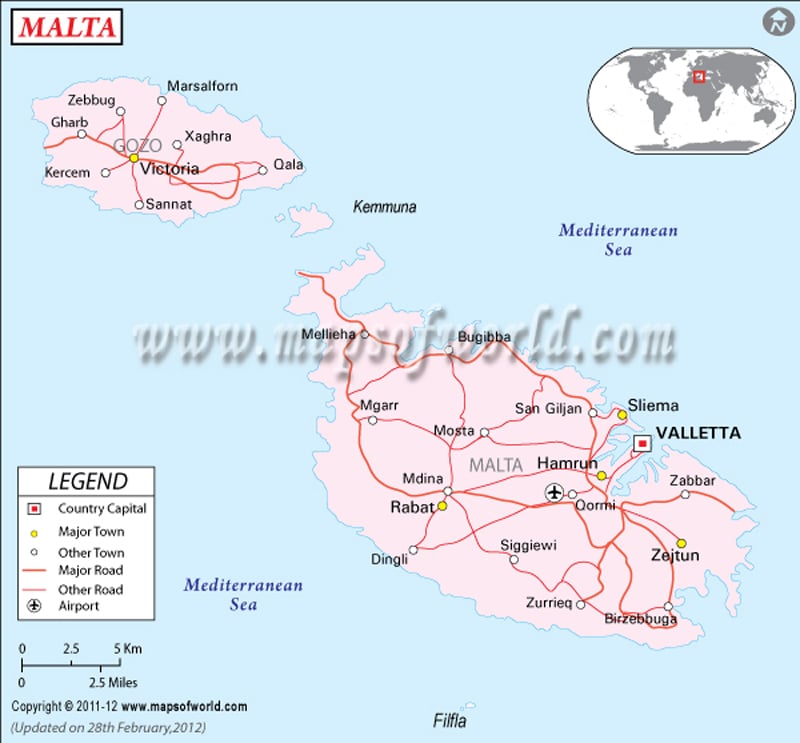
Malta is situated south of Sicily in the Mediterranean Sea. The archipelago is stretch over an area of 316 square kilometers. Valletta is the capital of the island country and is pointed by a red dot on the Malta map. The red lines on the map project roadways of the country while the black dots represent the important cities of Malta. The geographical coordinates of the country are 35° 50′ North latitude and 14° 35′ East longitude.
Location and Geography of Malta
The political map of Malta shows the country situated in Mediterranean Sea. It is one among the Mediterranean Sea islands lying south of Sicily. The latitudinal and longitudinal extent of the country is 35°50′ North and 14°35′ East respectively. The island country occupies an area of 316 square kilometers. The coastline of the country extends up to 196.8 kilometers. The country experiences Mediterranean type of climate. The elevation point of the country is Ta’Dmejrek situated at 253 meters above sea level. The lowest point is Mediterranean Sea.
Capital of Malta
The capital of Malta is Valletta. The map of Malta points the capital with a red dot. The city’s geographical coordinates are 35° 53′ 59” North latitude and 14°30’53” East longitude. The city is accessed by its only civilian airport located at Luqa. The neighboring cities are Sliema, Bighi, Vittoriosa, Wied Ghammieq, Il-Gzira and Il-Furjana.
Important Cities of Malta
The black dots on the map of Malta represent important cities. Some of the cities are listed below:
|
|
| Region | Population | Area(km.²) | Area(mi.²) |
|---|---|---|---|
| Central | 102,380 | 23 | 9 |
| Gozo | 31,007 | 69 | 27 |
| Northern | 85,834 | 113 | 44 |
| South Eastern | 89,974 | 77 | 30 |
| Southern | 95,767 | 34 | 13 |
| Total | 404,962 | 315 | 122 |

 Science and Technology Malta