12.1K
- Continent And Regions - Africa Map
- Other Madagascar Maps - Madagascar Map, Madagascar Blank Map, Madagascar Road Map, Madagascar Rail Map, Madagascar River Map, Madagascar Cities Map, Madagascar Political Map, Madagascar Physical Map, Madagascar Flag
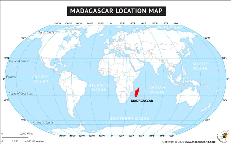
The country of Madagascar is in the Africa continent and the latitude and longitude for the country are 18.3714° S, 47.5424° E.
The neighboring countries of Madagascar are :
Maritime Boundaries
- Comoros
- France
- Mozambique
- Seychelles
- French Southern and Antarctic
- Mayotte
Facts About Madagascar |
| Country | Madagascar |
|---|---|
| Continent | Africa |
| Capital and largest city | Antananarivo |
| Area | 587,041 km2 (226,597 sq mi ) Water (%) 0.009% |
| Population | 22,005,222 (2012 Est.) |
| Lat Long | 20° 0′ 0″ S, 47° 0′ 0″ E |
| Official Language | Malagasy French |
| Calling Code | +261 |
| Time Zone | EAT (UTC+3) Summer (DST) not observed[9] (UTC+3) |
| Airport | 39- Airports (Commercial Scheduled Service) |
| Neighbour Countries | La Reunion, Mauritius and Comoros |
| Internet TLD | .mg |
| Currency | Malagasy ariary (MGA) |
