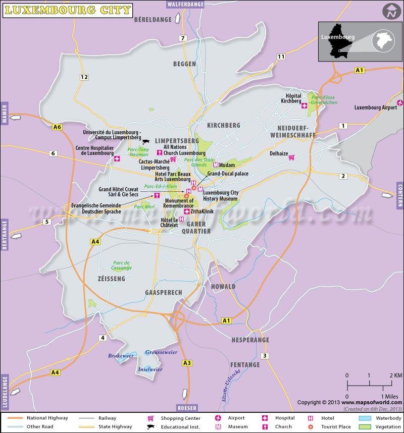
Luxembourg City is the capital of the country of Luxembourg in the European continent. The Luxembourg City carries remains of many old fortifications that are very well preserved.
It is due to this reason that one whole region of the Luxembourg-Ville got adjudged as a World Heritage Site by the UNESCO in the year 1994.
The underground tunnels, which are also known as casemates, are frequently visited by the tourists. Special provision of an open top tourist train, which is named as the ‘Petrusse Express’, offers many tours that are guided and travel through various important places in the Luxembourgian City. One of the most famous places, which can be visited on these open air train tours include the Petrusse Valley which offers views of many remaining fortifications in the Luxembourg City. This tour of the City of Luxembourg provides an insight to the visitors regarding the movement of life inside the former fortress. This open top train departs from an underground station below one of the arches at the Pont Adolphe viaduct.
Some other attractions at the Luxembourg City include the following:
- the Place d’Armesor the city’s main square which contains a large number of outdoor restaurants as well as cafes Palais Grand Ducal
- the official residence of the Grand Duke
- the Place Guillaume
- the 17th century Notre Dame Cathedral
- numerous galleries
- the National Museum of Natural History
- the National Museum of History and Art
- the Museum of the City of Luxembourg

 Grevenmacher