Solomon Islands Latitude and Longitude Map
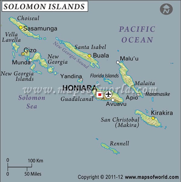
Solomon Islands's latitude and longitude is 8° 00' S and 159° 00' E . Below is the map of Solomon Islands showing major towns, roads, airports with latitudes and longitudes plotted on it.
Search For Latitude & Longitude Map
Or
Latitude
Longitude
Or
Area
* Put South & West values with minus ( - ) sign.

|
| Description: Find Solomon Islands latitude and longitude map showing comprehensive details including cities, roads, towns, airports and much more. | Disclaimer |
The latitude of the Solomon Islands is in close proximity to the equator and with the Tropic of Capricorn to the other side. The climatic condition of this country is tropical in nature. There are few extremes of weather in the Solomon Islands as it is surrounded by sea.
The latitude and longitude of the capital of the Solomon Islands is 9° 26'South and 159° 57'East. The longitudes of Solomon Islands are to the extreme east of the Prime Meridian and close to the International Date Line. The standard time of Solomon Islands thus is 11 hours ahead of the Greenwich Mean Time. The time difference with Washington DC is sixteen hours.
| Locations | Latitude | Longitude |
| Guadalcanal | 09°32'S | 160°12'E |
| Honiara | 09°27'S | 159°57'E |


