logo


Myanmar Latitude and Longitude Map

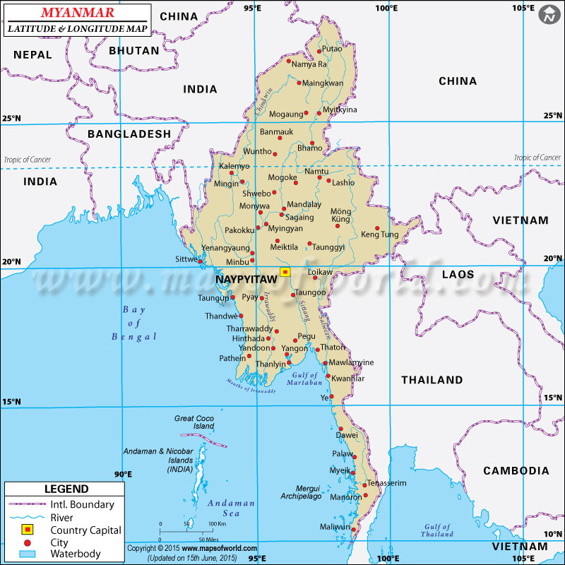
Myanmar's latitude and longitude is 22° 00' N and 98° 00' E . Below is the map of Myanmar showing major towns, roads, airports with latitudes and longitudes plotted on it.

Myanmar Latitude and Longitude Map
Nepal Latitude and Longitude Map Bhutan Latitude and Longitude Map China Latitude and Longitude Map China Latitude and Longitude Map Bangladesh Latitude and Longitude Map India Latitude and Longitude Map China Latitude and Longitude Map Vietnam Latitude and Longitude Map Laos Latitude and Longitude Map Thailand Latitude and Longitude Map Cambodia Latitude and Longitude Map Vietnam Latitude and Longitude Map Andaman and Nicobar Map
Description : Find Myanmar latitude and longitude map showing comprehensive details including cities, roads, towns, airports and much more. Disclaimer
×

Disclaimer  :  All efforts have been made to make this image accurate. However MapSherpa, Inc, its directors and employees do not own any responsibility for the correctness or authenticity of the same.


The main latitude and longitude of Myanmar is 22° North and 98° East. The total area which falls within the latitudes and longitudes of Burma or Myanmar is 678,500 square kilometer. The latitude of Myanmar falls in between the Tropic of Cancer and the Equator. As Myanmar falls within the tropical zone the climatic conditions are in line with the other tropical countries. The summers are hot and humid and even during the winter rainfall continues and the temperature remains mild and pleasant.

The latitude and longitude of the capital of Myanmar , Yangon, is 16° 47'North and 96° 10'East. As the longitude of Myanmar is in the east of the Prime Meridian the time difference from the Greenwich Mean Time is six and half hours ahead. There is only one time zone of Myanmar and the time difference from the Washington DC standard time is about 11.5 hours.


Last Updated on: December 28th, 2016