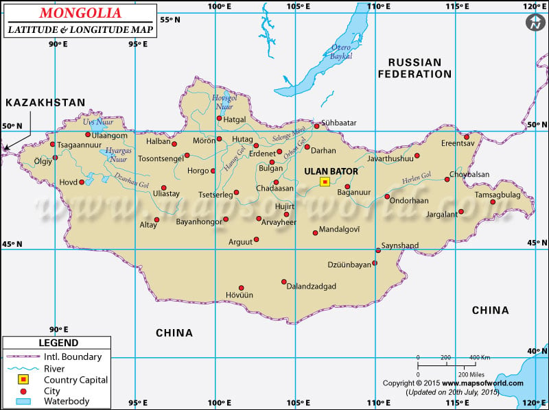
Mongolia is located within the
latitude and longitude of 46° 00 N, 105º 00 E. Mongolia is located in the northern Asia, between China and Russia. The capital city of
Mongolia is
Ulaanbaatar.
The latitude and longitude of Ulaanbaatar, the capital city of Mongolia country is a47º 55' N, 106º 53 E'.
The latitude and longitude of Mongolia includes 1, 564, 116 sq km of total land area. The landscape within the
latitude and longitude of Mongolia includes vast semi desert and desert plains as well as grassy plain.
In the west and the south-western side of this region includes mountains. The climate of this region is continental in nature. Within this
latitude and longitude of Mongolia s ummers are usually dry and sunny. Sunny days are common to this region. Summer temperatures often rise up to 60°-70° F. On the other hand, winters here are very cold and often windy. In the winter low temperatures often fall below freezing point.
Last Updated on: May 26th, 2023
